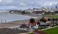
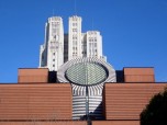
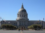
San Francisco Bay can be described as a shallow estuary that drains most of the water from approximately 40 % of California. Water the from San Joaquin River, Sacramento River and Sierra Nevada mountains passes via this bay to Pacific Ocean. This bay is located in California, United States and is surrounded by contiguous region called San Francisco Bay Area. This area is dominated by large cities such as Oakland, San Francisco and San Jose.
Size of the Bay
Depending on the sub-bays, wetlands and estuaries included during the measurement, the Bay covers an area of between 400 and 1,600 square miles. The main section of this bay measures around 3 to 12 miles in width (east-to-west) and about 48 to 60 miles north-to-south. This is the biggest Pacific estuary in America.
There are 5 large islands in this bay: Alameda is the largest island which was created when a shipping lane was made in 1901. Angel Island, which is now state park, is accessible by a ferry. It served as entry point for the many immigrants from the Eastern part of Asia. Yerba Buena Island together with the Treasure Island both were used as military bases during Second World War; today, the islands are now being developed. The fifth island is called Mare Island and is located in northern part of this bay.
Ecology
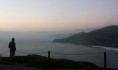
Despite having an urban and an industrial character, the San Fransciso Bay and Sacramento-San Joaquin Delta still remain as California’s most popular ecological habitats. Dungeness crab, Pacific salmon fisheries and California halibut all rely on this bay as a nursery. The bay is known for having protected waters and estuaries.
Each and every year, millions of waterfowl use the bay-shallows as refuge. Two endangered species of rare of birds can be found here; the California clapper rail and the California least tern. The exposed bay mud also provides feeding areas for the shorebirds. The salt produced by the bay is shipped all over the Western United States to bakeries, fisheries, canneries and various parts of the food industry. The salt is used in many other industries such as in de-icing winter highways, cleaning kidney dialysis machines and for animal nutrition.
Transportation
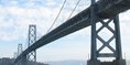
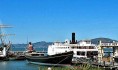
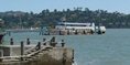
Long before the Europeans came, the bay was simply traversed by watercraft. The locals used canoes to go fishing and clam along shorelines. The canoes were then slowly replaced by some powerful steam-powered vessels around the 19th century. Today, the bay is spanned by about eight bridges; all bridges are dedicated to car traffic. The bay serves as an important international shipping port that is served by a huge container facility that is operated by Port Oakland.
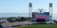
Recreation
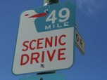
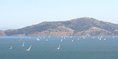
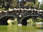
The San Francisco Bay Area has become a home to many of the world’s top sailors. The consistent strong thermally-generated (westerly/northwesterly) winds make windsurfing and kite surfing a popular activity here. Yachting plus yacht racing are also popular pastimes. A shore-line bicycle plus pedestrian trail called the San Francisco Bay Trail follows the edge of the water. There are also some parks and other protected areas just around the Bay that can be visited by the public. Some of them are: Cesar Chavez, Point Isabel Regional Shoreline, East shore State Park and Hayward Regional Shoreline.