The Nabatean Tombs

Tomb, Palmyra
The Nabatean Tombs, Saudi Arabia
Photo by: ian.plumb , Creative Commons

The Nabatean Tombs in Saudi Arabia were intricately designed. They are numerous in number and generally large in size. They were often similar to each other but each had their own personalized inscription. Nowadays, you will find many signs to warn visitors not to defile the tombs. What makes these tombs so appealing is their intricate designs over entrances and inside the curves of the rock.

These mysterious tombs really have a lot of history to offer. This is what attracts most people to visit them. It is not just the numerous amounts of tombs and ancient ruins, but what life was like in those days. How did they build the Nabatean tombs? What is inside the tombs? There are many burial tombstones not only in Saudi Arabia but also in other cities. Most of the tombs were created for families and tribes in the ancient days. They might contain as many as a hundred people. There were also many graveyards surrounding the tombs for the common people. The Nabatean tombs were only for the rich. This reveals that they could have possibly believed in an afterlife because they want to be buried with family.

If you are wondering about who built such tombs, they were Nabatean sculptors and not slaves of a different race. Another thing to ponder about is the fact that Nabateans mostly lived in tents during the early days. Visit the Nabatean tombs now to grab hold of the mystery everyone is talking about. Share the culture, the history, and the magnificence of the tombs.

December 25, 2009 at 6:18 pm | 2 comments

Copacabana Beach

Copacabana Beach 400
Copacabana Beach, Brazil
Photo by: Soldon, Creative Commons

The stunning Copacabana Beach is what always enters people’s minds when they think of the beautiful beaches in Rio de Janeiro, Brazil. It is vast, crescent shaped and very lengthy. It is absolutely perfect for swimming and sunbathing. It is bordered at one end by the widely known Pão de Açucar also called Sugarloaf Mountain that lies just off the shore, and on the opposite end, by the former Copacabana Fort. The beach itself is actually rather wide in areas and much plainer compared to the neighbouring Ipanema Beach. It switches into the Leme beach on the beach’s eastern area and ends with the Leme Mountain.

This two and a half mile long beach in Brazil is one of the most attractive beaches all over the world. It is made very popular by the indoor and outdoor restaurants, bars, luxury hotels, night clubs, and casinos lined up from end to end. Thousands of tourists flock to Copacabana Beach every day. The Copacabana Beach is lit up every night by huge lights, providing a dreamlike feeling and appearance to the entire scene. In spite of the excellent lighting, it is said to be risky to walk around the beach at night and after dark is much safer to stay near the hotels.

Majority of the tourists and the Brazil locals gather together in the popular Copacabana Palace Hotel at Posto 2 to about Posto 5. Across this hotel is the well known gay area of the beach. It is even marked by a rainbow flag and is raging with activity on sunny days.

The most widely played sport on the Copacabana Beach is soccer. However, you can also find other games being played all over the beach from morning until the early evening.

December 25, 2009 at 12:26 pm | 1 comment

Lahore Fort


Lahore Fort
Photo by: wikipedia , Creative Commons

If you are looking for an elegant and spectacular site for your visit to Pakistan, it is a must to go to Lahore Fort. Historians believe that as early as 1021, there was a mud fort in the locale built by Mahmood of Ghazna. It was not until 1566 when the actual structures were actually constructed, as per the instructions of Mughal Emperor Akbar the Great who allegedly destroyed the mud fort on the old foundations. The current fort is being enjoyed by tourists today is a result of centuries of additions by different entities occupying the area.

The Lahore Fort is rectangular in shape. There are two main gates found in the center of the walls located in the east and west of the fort walls. All Mughal emperors that have succeeded Akhbar, the Sikh rulers that overthrew the Mughals, and the British have contributed to the way the fort is now, thanks to their additions of walls, palaces, and pavilions. A significant addition and a must-visit for tourists would be the additions made by Emperor Jehangir. He extended the gardens and constructed a couple of palaces which is now known as the fort’s Jehangir’s Quadrangle.

Other structures worth visiting are the additions made by Shah Jahan, such as the Pearl Mosque and Diwan-e-Khas. The remarkable main gate is courtesy of Aurangzeb. This main gate faces other beautiful edifices such as the Badshahi Mosque. If you want a bit of war history, have a look at the Elephant Steps’ walls, where bullet marks brought about by 1847’s sikh Civil War can still be seen. Alas, a visit to the fort will not be complete without dropping by the Palace of Mirrors, or Sheesh Mahal. This palace is located in the northeast portion of the fort. Regarded by most of people who have been there as the fort’s most beautiful place, it houses several mirrors in different colors that simply dazzle the eye.

December 25, 2009 at 11:43 am | No comment

Tivoli Gardens

Tivoli Gardens 400
Tivoli Gardens, Denmark
Photo by: Jeaneeem , Creative Commons

The famous Tivoli Gardens have always been one of the favorites of tourists who travel to Denmark. Who would not be attracted to the grandeur of this theme park that was built in the 1800s? That was the time when King Christian VIII agreed to lease an architect who would want to build a park. Well, it’s not just an ordinary park since he had a lot of requirements. When it was finished, flowers, man-made lakes and trees welcome your senses.

This enthralling sight captures millions of tourists since the Tivoli Gardens have so many activities in store for them. Just imagine riding roller coasters and ferris wheels while eating just about anything that is being sold along the way – frankfurters of course. It is such an amazing view the moment you get to see the flowers. You will not get lost when you look for the Tivoli Gardens since the moment you exit the Central Station of Copenhagen, you will immediately see it. So spending some quality time in Denmark can make your stomachs grumble for their wonderful food but keep in mind that this is a place of expensive things, so might as well bring enough kroners for you to get by.

Talking about what is great and enticing about Denmark, you will soon realize that aside from food and drinks, music comes first of them all. There are over a hundred free concerts you can go to when you visit the Tivoli Gardens. During their operating hours, you can chose from a variety of genres that would bring beautiful memories back. It is definitely one part of Denmark to grand and too close to the heart to ignore.

December 24, 2009 at 5:36 pm | 1 comment

Bosra Amphitheater

Bosra Amphitheater 400
Bosra Amphitheater, Syria
Photo by: upyernoz , Creative Commons

Syria is a country of ancient cities and Bosra is one of the most fascinating. Bosra is located in the Horan Plain and was first mentioned in the 14th-century-BC Hieroglyphics of Akhnatoun and Thutmos III. The city became the capital of the Nabatean kingdom a thousand years later. Bosra also experienced Greek, Roman, and Byzantine reign as well as Arab Muslim and Mongol invasions. Although it was under the control of various cultural groups, the city flourished the most under and was greatly influenced by the Romans, and this is most evident in the Bosra Amphitheater, which is the ancient city’s most impressive feature. The amphitheater was built by the Romans in the 2nd century AD, and despite being converted into a fortress by the Ayubids during the Crusades, the original theater has been miraculously preserved. It can accommodate up to 15,000 spectators and has a stage that is almost 148 feet long and approximately 26 feet deep.

The Romans designed the Bosra Amphitheater in such a way that the whole audience can hear the actors without having to use any special equipment. The large area in front of the stage may have been used for gladiatorial matches or circuses. The Bosra Amphitheater also boasts tall stage buildings and stands out from other Roman theaters because it is one of the few freestanding amphitheaters ever built by the Romans. Around the theater are the ruins of the Ayyubid fortress, which may have played a large role in the excellent preservation of the amphitheater. Most of the columns in the amphitheater have been restored and renovated, so that visitors can admire the way the columns looked like when they were first erected. In its prime, the theater had marble facades and silk hangings. During performances, a fine mist of scented water was sprayed over the audience to keep everyone comfortable in the desert heat.

December 24, 2009 at 4:40 pm | No comment

Taktsang Monastery

Taktsang Monastery 400
Taktsang Monastery Tourist Guide
Photo by: Taxidesign , Creative Commons

The Taktsang Monastery or the Tiger’s Nest Monastery is said to be one of the main monasteries that contributed to the start of Buddhism in Bhutan. The beauty of Taktsang Monastery is clouded with impossibility that will definitely amaze you since the monastery itself is situated on the edge of a mountain cliff one thousand meters above Paro Valley.

According to legend, Guru Rinpoche arrived on a cave riding a tigress that flew over from Tibet to the Himalayas. The place where Guru Rinpoche meditated for three months is now, seven centuries later, The Tiger’s Nest Monastery, which is one of the most distinct monasteries in Bhutan because of its location.

What You Should Not Miss

While trekking to get to Taktsang Monastery, you will see the monastery from afar. The monastery might seem quite close at first but most tourists are surprised by how far it actually is. Along the paths, you will see various stones and prayer flags that lead you to the monastery. Prayer wheels and Chortens are also present along the paths and they should not be missed.

Reaching the temple will be a breath of fresh air. Moreover, the exhaustion felt will definitely get replaced with amazement with the beauty of the monastery and how it emanates a sacred feel that will make you feel calm and focused.

What You Should Remember

It is advised that you prepare yourself for the trek and make sure that you bring all of your essential needs. A bottle of water in handy will be important and it is also advised to bring a bar of chocolate to give yourself a boost.

Wear light clothes when going to the monastery since the weather can get quite hot during the day. However, you will need to wear sleeved clothing since you are not allowed to enter the monastery when wearing clothes that reveal too much skin. Taking photographs inside the monastery is also prohibited.

December 24, 2009 at 4:00 pm | No comment

Cu Chi Tunnels

Cu Chi Tunnels 400
Cu Chi Tunnels
Photo by: joergreschke, Creative Commons

The Cu Chi tunnels in Vietnam will definitely leave you breathless with amazement. The rich, yet atrocious history of these interconnected underground tunnels will educate you on how the Vietnamese created tunnels that spans more than two hundred kilometers with the use of simple shovels to dig the hard red earth.

What You Should Not Miss

Though it will not be possible to explore every tunnel in just one day, you can experience the feeling of being underground the Cu Chi tunnels through guided tours that usually last half a day. Most tourist packages include a guided tour in the Cu Chi tunnels so you won’t have any problems when booking one.

Underground, you should not miss the hospitals, the underground factories, and the underground villages that once housed both the civilians and the Viet Cong. You will surely feel the struggles and the challenges felt by the Vietnamese while living underground and while protecting themselves from the continuous bombings and the wars which broke out.

What You Should Keep in Mind

The Cu Chi Tunnels are two and a half hours away from Saigon when taking the bus. It is advised that you sit by the window and enjoy the landscapes and the view to kill boredom. From the Tan Son Nhat International Airport, there usually are private tour buses included in most tour packages that take you directly to the Cu Chi tunnels.

All throughout the year, the Cu Chi Tunnels are open; however, it is advised to take the tour during summertime which is from March to May so that you won’t experience any rainfalls.

Souvenir shops are abundant in Cu Chi where most locals sell unique items and delicacies, bringing Vietnamese Dong will make transactions easier since you will be transacting with the locals. Money changers are also available though you are only advised to trade for emergencies because of a lower exchange rate.

December 24, 2009 at 3:03 pm | 8 comments

Kings Canyon National Park

Kings Canyon National Park 400
Kings Canyon National Park
Photo by: paleontour , Creative Commons

Rocky and dry, orange to red, many tall cliffs and steep gorges, walks and more walks – these are what tourists should expect at Kings Canyon National Park. Located inside the Watarrka National Park, Kings Canyon overshadows its mother park as everyone refers to it, from the tour packages down to resort names rather than the original Watarrka. The park houses the George Gill Range and offers outdoor experience for adventure hikers.

The park is almost reddish due the over abundance of sandstone in the area. With its burnt valleys and cliffs, the scenic spots will most likely be dominated by two hues, red for land and blue for the sky.

Activities include walking, hiking and driving around the rocky hills. Popular walks include the King Creeks Walk and the King Canyon Rim Walk. The first one is an hour of easy walks while exploring the vegetation and wildlife of the canyon. Meanwhile the King Canyon Rim Walk is the opposite. It is a difficult walk that requires much experience and strong fitness while trailing the steep steps. Other notable walks include the Kathleen Springs Walk which is the easiest of all and the Giles Track, which needs a straight two days with overnight camping to finish. Scenic spots and walking stops for picturesque view include the Garden of Eden and the Lost City, both a natural wonder of rocky formations in the park.

To visit, it is advisable to use a car. However, for a better and satisfying outdoor exploration, an off-road vehicle is advised to be able to climb the rocky and steep curves of the canyon. In no time you will be stopping to set foot on the canyon’s floor. The best season to visit is during the cool months, from April to September, to avoid the scorching heat of the sun in the arid land.

Kings Canyon National Park

December 24, 2009 at 1:06 pm | 2 comments

Sanctuary of Bom Jesus do Congonhas

Sanctuary of Bom Jesus do Congonhas 400
Sanctuary of Bom Jesus do Congonhas
Photo by: geoglauco, Creative Commons

The Sanctuary of Bom Jesus do Congonhas in Brazil was built in the 2nd century. It includes a church with a luxurious, ornate, Italian-inspired interior design, including an outdoor staircase adorned with beautiful statues of the prophets; and 7 chapels depicting the seven Stations of the Cross.

The small chapels and the church are very picturesque. They are located on a sheer hill, peeking above the other edifices in the neighbourhood. Each of the seven statues of the prophets is very unique, possessing its own posture and character.

The story behind this World Heritage Site is about two extraordinary men, Feliciano Mendes, the Portuguese immigrant and Aleijadhino, the sculptor. With Aleijadhino being the artist and Mendes being the fundraiser, they built a set of architectural monuments within the city of Congonhas. These monuments were then considered the greatest of Brazilian art.

The Sactuary of Bom Jesus do Congonhas is located in the historical Brazilian city of Congonhas, also called Congonhas do Campo. The city is found in the state of the Minas Gerais. It is located ninety kilometres (fifty-six miles) southwards the Belo Horizonte, which is the capital state of the Minas gerais, near the highway of BR-040. Congonhas has a populace of fifty thousand.

The city of Congonhas actually became well-known for the sanctuary and the linked statues which were ordered by Feliciano Mendes, the Portugese adventurer, in the eighteenth century. It was made by Aleijadhino, who is among the greatest artists of baroque art throughout the world. The soapstone statues of the prophets of the Old Testament circling the terrace are believed to be one of his best works. In the year 1985, the United Nations Educational, Scientific and Cultural Organization (UNESCO) awarded the Sanctuary of Bom Jesus do Congonhas a title of being one of the World Heritage Sites.

December 24, 2009 at 12:26 pm | No comment

Fes

Fes 400
Fes, Morocco
Photo by: omarsc , Creative Commons

Fes is a heady, intoxicating mix of the old and the new, a medieval city side by side with a Westernized area lined with modern shops and hotels. It is Morocco’s cultural and religious center, with three distinct areas – the old walled city of Fes el-Bali (declared a UNESCO Heritage Site in 1981), Fes-Jdid, which is home to the old Jewish quarter, and the modernized Ville Nouvelle, which was built by the French and is a bustling commercial center.

The first stop for tourists should, of course, be the old city. You enter it through the Bab Boujeloud gate, one of Morocco’s most famous attractions. It is interesting to note how the color of the mosaics change once inside the gate – from the outside it is blue, the color of the city, but inside the tiles are green – the color of Islam. Make sure to dine at one of the main rooftop restaurants located at the city square where you can while away the time with a great overhead view of life in the city while you nurse your mint tea.

To get an overview of traditional Moroccan culture, you can visit the old city’s three museums – the Nejarine Museum of Wooden Arts and Crafts, the Dar Batha Museum and the Belghazi Museum. The last one also sells the blue pottery the city is famous for. The old city’s Islamic schools or medersas offer glimpses of the craftsmanship of the Merenid Dynasty, which made Fes their capital from 1269 to 1420. The Medersa Bou Inania has some excellent examples of Merenid woodwork and plasterwork while the Medersa el-Attarine has an incredible view of the city from its rooftop. Also a popular attraction is the tanner’s quarter, which harks back to a time when Fes was a major center of leather goods manufacturing, where from a platform tourists can look down at the tanneries and see how they do their work.

December 24, 2009 at 11:50 am | 3 comments

Beaubourg

Beaubourg
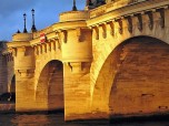
Beaubourg in Paris, France
Photo by: Leland, Creative Commons

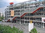
If you are planning to visit France, then you must not forget to tour around Beaubourg. Recognized as Centre Georges Pompidou, Beaubourg is a building that embraces both literature and art. It stands 42 meters high and contains eight floors, three of which are underground. It was conceptualized by a British Architect couple, Richard and Sue Rogers and Italian architect Renzo Piano in 1969 during President Georges Pompidou’s supremacy. Construction lasted five years and was completed in 1977.

There is a huge glass escalator, located in front of the building. This escalator can take you to and from the upper levels where you can enjoy the views of Notre Dame Tower, Saint Jacques Tower and the famous Basilique du Sacré-Cœur.

One of the major attractions in Beaubourg is the National Museum for Modern Art (or Musée National d’Art Moderne in French). Enormous assortments of modern masterpieces from 1905 to the present are shown here, including the works of 20th century art masters like Pablo Picasso.

The structure also houses France’s largest library, the Bibliothèque Publique d’Information, which is situated on the second and third floor. This library, which primarily showcases French literature, has two million books and periodicals from different countries. It also has an audio-visual room and a language laboratory, which are open to the public.

If you would like to see the streets of France in the medieval period, then just head to the square in front of Beaubourg itself. Acrobats, musicians and street actors perform here until the evening to entertain the tourists. Souvenirs, on the other hand, can be purchased in shops surrounding the center.

Truly, Beaubourg is a refuge of French modern masterpieces. Visiting such a place is worth your travelling expenses. Enjoy the privilege of traveling by going to Beaubourg as soon as you land in France.

Paris Famous Landmarks

December 24, 2009 at 11:15 am | No comment

Mons Klint

Mons Klint 400
Mons Klint
Photo by:
Allie Caulfield
, Creative Commons

Traveling to different countries enable you to experience their hospitality, food and sights. That is why when traveling or planning for a most awaited for trip, you have to choose Denmark. There are millions of tourists every year who discover the breathtaking view of different landmarks found at the eastern part of Mon Island. This is none other than the Mons Klint. It is a Danish term that means “Cliffs of Mon” in English.

You might think that it could be another ordinary cliff you can climb and look down the very edge – the Mons Klint is quite different from the usual rocky boulders that you are accustomed too. The 120 meter fall, six kilometers from Liselund until your eyes reach the Lighthouse, all you will see is chalk. Yes, it is quite a spectacular view even though the area surrounds the whole Mons Klint houses ponds, marshes and woodlands. This might make you wonder wherein the world would the chalk come from. According to the locals in Mons Klint, the chalk was the remnants of shells that lived at the seabed for more than 70 million years ago. So when the white formations grew thick, they transformed into chalk.

This part of the Baltic Sea may become nippy so do not forget to bring medium to thick clothing during your visit to the beautiful place. You still can tug along your handy camera when you get to the top of the cliff since there is a geological museum where you can learn more about how the cliff keeps on chalking up snow like matter. Transportation is not a problem in this part of Denmark since all landmarks like this can be easily reached through bus. Fortsat god dag! This means “Have a Nice Day” in Danish.

December 23, 2009 at 8:57 pm | No comment

Den Gamle By

Den Gamle By 400
Den Gamle By, Denmark
Photo by: Erik Kristensen , Creative Commons

Journey back in time with a visit to Den Gamle By, also called The Old Town, in Denmark, just outside of Copenhagen. This open-air museum is a faithful recreation of a Danish market town as it looked like in past times. The museum opened in 1914, and since then has attracted numerous visitors, which recently averaged about 3.5 million tourists visiting every year.

The buildings that comprise this old town are structures that were originally built between the mid-1500s to late 1800s. A total of 75 buildings coming from twenty towns and cities in Denmark are found in this one-of-a-kind museum. The largest buildings are the mayor’s mansion (circa 1597), the coin master’s mansion (circa 1683), and the Aalborg Estate (circa 1570 and 1807). Aside from these, visitors can wander around and explore ordinary residences, various workshops, watermills, windmills, a small dock for construction of boats, and a tobacco barn.

In order to add life to the historical feeling of the place, museum staff are dressed in and pose as carpenters, hatters, bookbinders and other craftsmen in the different workshops that dot the town. Visitors can also get inside a pharmacy, a school, and even use the services of an old-fashioned post office.

Tourists can feast their eyes on the antiques on display at the Burgomaster’s House, a wealthy merchant’s home that was built around the end of the 16th century. There are also collections of china, textile, clocks, and silverware throughout the museum. After much walking around, one can get some refreshments at the restaurant, bakery, tea garden, or the beer cellar. Children are encouraged to visit. Entrance is free for visitors 16 years old and younger, and many of the activities and programs in the old town are designed for kids to participate in. They will surely enjoy themselves especially in the Toy Museum where 6000 toys from the 1800s to the 1960s are in display.

December 23, 2009 at 6:07 pm | No comment

Sigiriya

Sigiriya 400
Sigiriya, Sri Lanka
Photo by: lucagorlero , Creative Commons

Sigiriya which means Lion’s rock, is an ancient fortress made of rock in the Matale district of Sri Lanka. The fortress is surrounded by the remains of an extensive network of gardens and other structures.

The place is part of the list of UNESCO World Heritage sites and is preserved due to its significance in illustrating architecture and culture of the civilization during the time it was built.

The fortress was built around the time of King Kassapa I, between AD477-AD495. For its age, it still features the creativity of its builders by showing that the palace could withstand the test of time.

The fortress was meticulously designed and built. The site plan allowed the use of the natural geometrical forms of its surroundings to be integrated in symmetric and asymmetric design utilized by the builders.

The fortress has some of the first landscaped gardens in the world of that time. There are three basic types of gardens in the surrounding area which are the water gardens, the boulder gardens, and the terraced gardens.

The water gardens contain three principal gardens. The first garden is an island that is connected to the main precinct by four causeways. Each causeway has a gateway connected at its head. The second garden contains two long deep pools. The third garden can be found at a higher place than the other two. It contains an octagonal pool with a podium on the corner.

The boulder gardens contain boulders that line a pathway. These boulders were used as building materials or foundation of a structure perched on top of the boulders. One such structure is the audience hall of the king.

The terraced gardens can be found on a hill at the base of the Sigiriya rock. It was formed on the side of the hill through a series of terraces.

December 23, 2009 at 5:22 pm | 1 comment

Arenal Volcano National Park

Arenal Volcano National Park 400
Arenal Volcano National Park
Photo by: dipfan, Creative Commons

Arenal Volcano National Park is found within the Arenal Tilaran Conservation Area in the central part of Costa Rica. Inside the park are the Arenal Volcano, Lake Arenal, the Lake Arenal Dam, and another volcano called Cerro Chato or Mount Chato as it has already been inactive for 3500 years. Unlike Cerro Chato, the Arenal Volcano used to be dormant until it had a major eruption in 1968. Since then, there has been constant volcanic activity in the area specifically in the volcano’s Crater C. There is presently lava flow of andesite basaltic compostion, gas emissions, and explosions of pyroclastic materials.

Adventurous travelers who wish to witness this volcanic activity can take part in the various tours arranged by the park management. From the park, visitors can view Arsenal’s lava flow and eruptions. The directions of the lava can change any time thus it is important to follow the guides strictly. At present, Arsenal’s lava is flowing toward the west and southwest side. Visitors will hike through trails that are two to three kilometers long. Traversing these trails will take one into young secondary forests and old lava fields. Visitor safety is a priority thus park rangers are always updated on current volcanic activity so they know which trail is open and safe.

There are a handful of tour combinations being offered that range from four to six hours. Depending on the your plans, you can take a morning or afternoon tour to hike in the Arenal Volcano and visit one of the hot springs in the area. You can choose to visit the Tabacon Hot Springs, Baldi Hot Springs, Eco Thermales Hot Springs, Titoku Hot Springs, or the Perdidos Springs. Lunch or dinner is included in the tour.

Visitors can plan an overnight accommodation at the Arenal Observatory Lodge and at the Museum of Vulcanicity.

December 23, 2009 at 12:56 pm | 2 comments

Ipanema Beach

Ipanema Beach 400
Ipanema Beach, Brazil
Photo by: Skellig , Creative Commons

In the southern area of the lively city of Rio de Janeiro, Brazil, is a public beach called Ipanema Beach. It permits the tourists to have fun under the sun and enjoy the sand with pleasurable freedom. It was widely known in the past for defining what a posh beach culture is really like. Ipanema beach became popular for innovations of stylish beach wear like the dental floss bikini, tiny tanga bikini, and the G-string crocheted for men.

Each part of the beach is unique and attracts various sorts of people. Some of the interesting spots in the beach are Garcia, Teixeira, Farme Gay, Cap Ferrat, Country and Posto9.

You can indulge yourself in fun beach games such as fresco ball, cycling, rollerblading, beach volleyball, soccer, surfing, swimming and even tanning on the sands, which the Brazilian locals pompously sport. Aside from these activities, there are many other things you can do. At night, the town boosts levels of fun with bars, night clubs and lounges. One of the thrilling happenings in Ipanema Beach that you should not miss is the well-known Carnival. Thousands of tourists enjoy this event that boasts the colourful culture and local liveliness.

Aside from these activities, there are a lot of other things you can do. At night, the town boosts levels of fun up with bars, night clubs and lounges. One of the thrilling happenings in Ipanema Beach that you should not miss is the well-known Carnival. Thousands of tourists enjoy this event that boasts the colourful culture and local liveliness.

Notable shopping areas are Visconde de Piraja and the Hippie Fair every Sunday, if you are on a budget. There are a lot of good places to stay depending on your budget. Ipanema Beach offers a variety of economical motels to five star hotels. Some notable areas that have reasonable price accommodation are Flamengo, Catete and Gloria.

December 23, 2009 at 12:28 pm | 1 comment

Bonifacio

Bonifacio 400
Bonifacio, France
Photo by: Orange Robber , Creative Commons

If you want to visit a place in France that will make you appreciate both the land and the sea, then Bonifacio is the place you are looking for.

The City of Bonifacio is situated in the southernmost part of the Corsica peninsula, detached from Sardinia by a strait also known as Bonifacio. It is considered the oldest town in the region. It is divided into two cities: the Upper City (or La Haute Ville among locals), which boasts the modern Mediterranean residence and the Old Town (or Vieille Ville) that depicts medieval-inspired houses of the 9th century.

Bonifacio serves as France’s hot spot during summer where French and tourists alike can spend their vacation. In the Upper City, visitors can take pleasure in several beach leisure activities like windsurfing, yachting and diving. People can also enjoy the limestone formations seen on the cliffs of the harbor.

The Old Town was preserved by the French government in order to portray the history of Corsica. A stone staircase that leads visitors from the Upper City to the Old Town, known as the Staircase of the King of Aragon, exemplifies beauty that lasted for many centuries. Once you have entered Vieille Ville, you can see and feel the scenery of 9th century France. The two Genoese towers built as Bonifacio’s landmark, Torra di Sant Amanza and Torra di Spansaglia are the main attractions in the Old Town. These towers, which amazingly stood the test of time, are often visited in Bonifacio.

Another attraction is the Monument of the Dead, which served as the resting place of both the ordinary and prominent citizens of Corsica in the medieval times. You will be pleased with the Gothic structures that can also give you that eerie feeling.

If you think that Bonifacio is a remote area, then don’t worry, you can reach it through the Figari Airport or through ferries coming from Sardinia. All you have to do is mark that calendar and bring your whole family to Bonifacio.

December 23, 2009 at 11:15 am | 5 comments

Crac des Chevaliers

Crac des Chevaliers 400
Crac des Chevaliers, Syria
Photo by: martijnmunneke, Creative Commons

Many people think of castles as a European phenomena, but many don’t realize is that the design of many European castles still standing today were based on Crac des Chevaliers, one of the best-preserved medieval castles in the world. In the 11th century, Arabs built the castle upon previous fortifications on a high stone mountain about 2,132 feet above sea level. The citadel was erected mainly to control the Homs Gap, a pass that connected Syria to the Mediterranean for thousands of years. During the era of the Crusades, knights found that the Homs Gap was crucial in controlling the coast, so they occupied Crac des Chevaliers where they could better control the coast and the inland cities. When the castle was occupied by the Crusaders, a group of warrior Christians called the Hospitallers further strengthened and extended the citadel. The Crusaders found that the Arab fortifications were much more advanced than those back home, so they wisely spent their time in the citadel by learning more about Arab castle-building techniques, which they later on brought home to Europe.

Thanks to the castle’s excellent condition, present-day visitors can marvel at the fortress’s various architectural wonders. Crac des Chevaliers was given its imposing character by its elevated location and its walls and towers that reach up to the sky. Although it is partially ruined, the castle still retains much of its original structures, such as a moat that could be filled with rainwater through the use of aqueducts. The castle’s fine defenses can be seen in its two walls: the higher inner and the lower outer, which gave warriors a chance to attack enemies without having to leave the safety of the castle’s walls. Crac des Chevaliers was more than just a fortress, however, as it was also utilized as a monastery and a storehouse for horses, food, water, and other supplies. Due to its magnificent size, the castle could hold supplies that could last for up to five years for an army of 2,000 to 4,000 men. The citadel also contained a small Spartan town with a church and chapel, large halls, cisterns, stables, residential areas, courtyards, and storerooms, and many of these structures can still be seen today.

December 22, 2009 at 4:40 pm | No comment

Kakadu National Park

Kakadu National Park 400
Kakadu National Park
Photo by: Albertoog , Creative Commons

Home to a diverse number of flora and fauna, a vast landscape filled with majestic waterfalls and riverbanks, Kakadu National Park is an environmental and cultural sanctuary. A UNESCO World Heritage Site, Kakadu National Park is a main tourist destination in the Northern Territory of Australia that covers more than 4.8 million acres.

Like the popular Bungle Bungle Ranges in the west, Kakadu got its name from the incorrect pronunciation of an Aboriginal word, Gagudju, which is literally the lingua franca of the people.

Kakadu is home to a very rich and diverse ecosystem. Major rivers surround and flow in to the area. The East, West, and South Alligator River and the Wildman River are home to a variety of reptile species including the famed Fresh and Saltwater crocodiles. The park also has six different landscapes which underwent a lot of geological changes millions of years ago. A shallow sea 140 million years before, the Stone Country, or the Arnhem Land plateau was the only landform above the sea during that time. The southern hills and basins have its volcanic origins while the estuaries and tidal flats becomes the habitat of its flora. Other land parts include the outliers, the lowlands and the floodplains. The park also contains the biggest uranium producing mine in the world, the Ranger Uranium Mines.

Kakadu is also rich in history. Rock paintings made by the Aboriginal people are still present in the area of Ubirr and Nourlangie and are considered exceptional. Occupied and cultivated by the Aboriginal people dating 40,000 years ago, big portions of land still belong to them.

Visitors will be pleased to have a view of its waterfalls. The famous ones are Maguk, Gunlom, Twin Falls and Jim Jim Falls. Kakadu’s wildlife is also extensive. Rare species survive in the Yellow Water Billabong, Mamukala Wetlands, Alligator Rivers, Anbangbang Billabong and on the park’s forest. Australia’s pride, the kangaroo, together with wallabies, dingoes, crocodiles, frogs, birds, and insects live in those areas. With hundreds of varieties of birds, Kakadu is the best site for bird watching. Activities at Kakadu National Park include walking and wandering along the park, fishing and cruising on the waters, learning the history through the Aborigines art, but definitely not hunting of wild animals.

December 22, 2009 at 12:21 pm | 1 comment

Meknes

Meknes 400
Meknes, Morocco
Photo by: cytech , Creative Commons

Meknes was once touted as the Versailles of Morocco, when Sultan Moulay Ismail (1672-1727) was pursuing his plans for a grand royal city. His plans never came to fruition, but the edifices he did succeed in erecting continue to attract hordes of annual tourists. Moulay Ismail’s royal city consists of more than 50 palaces, 20 gates and a city wall 45 kilometers in length. One of the most impressive of the gates is the Bab el-Mansour, named after its architect, a Christian who converted to Islam. At present, it is used as an arts gallery and entry to it is only through a side gate.

Of the surviving palaces, the best preserved one is the Dar el-Makhzen, which is still used today by Morocco’s king as the royal palace. Dar el-Makhzen is closed to visitors, but glimpses of the palace can be seen through the crumbling walls. Visitors may also be interested in visiting Moulay Ismail’s mausoleum, although non-Muslims are restricted from entering many parts of it. Other attractions where large areas are forbidden to non-Muslims include the Muslim school Medersa Bou Inania and the mausoleum of holy man Sidi ben Aissa.

Those interested in a glimpse of traditional Moroccan arts and crafts should drop by the Dar Jamai, whose exhibits focus on items such as ceramics, textiles and jewelry.

Souvenir hunters will find plenty of them at the medina, large areas of which are devoted to qissariya, or covered markets. The quality of the items you can buy here are reportedly among the best in Morocco, and the prices more affordable. It is definitely a good place for visitors to hone their haggling skills. Since Meknes is a center of olive production in Morocco, the city is also a good place to pick up fresh olives, although prices can be steep so make sure to compare prices from different stalls.

December 22, 2009 at 11:51 am | No comment

Rohtas Fort

Rohtas Fort 400
Rohtas Fort
Photo by: jhelumi, Creative Commons

When it comes to historical structures, Pakistan is one place that is abound with them. The country is home to some of the most important and impressive historical sites anywhere in the world. Most of these historical monuments have caught the fancy of many travelers from all corners of the globe. Some of them have earned recognition from international cultural organizations. Among these attractions is the Rohtas Fort. Rohtas Fort has earned the distinction of being a UNESCO World Heritage Site. Thousands of tourists from Pakistan and beyond its borders have been impressed by the structure’s rich heritage.

Rohtas Fort, known in Urdu as Qila Rohtas, is located about 109 kilometers from the nearest city of Rawalpindi. It was built by Sher Shah Suri in 1541 to fortify his territory after being defeated by Humayun. Centuries of invaders, weather disturbances, and wear and tear have not deterred the imposing nature of the fort. The architecture of the fort is a beautiful example of the mix of Hindu, Pukhtun, and Muslim military styles.

The wall of Rohtas Fort stretches for at least four kilometers and has twelve gates in it. A number of the twelve gates are still in good condition, though some are in need of repair and maintenance. The 69 bastions in the fort serve to strengthen the fort’s walls, as well as give the structure elegance and sophistication. The fort, aside from protecting the area from invaders, used to house a number of families. Nowadays, only tourists come to marvel at the spectacle of the fort.

Tours to Rohtas Fort originate from either Islamabad or Rawalpindi. The main highway can be used to go to Rohtas Fort, and from the highway, one has to turn right to Deena, which is a railway station and a bus stop. Buses and trains can be taken from Deena straight to Rohtas Fort. An ideal time to visit the fort would be during the summer.

December 22, 2009 at 11:43 am | 1 comment

Transylvanian Alps

Transylvanian Alps 400
Transylvanian Alps, Romania
Photo by: peatc , Creative Commons

The Transylvanian Alps, or as Romanians would call it “Southern Carpathians,” is the mountainous territory of south-central Romania. It covers the part of the Carpathian Mountain arc from Prahova River valley to the break in which the Timiş and Cerna rivers flow. It has been classified into three groups of ranges. These beautiful mountains are more elevated, more blocked, and are closer to each other than those mountains in the eastern and western part of Romania, which means they are more exciting. Hiking these mountains would be the trek of a lifetime. And though they are close to each other, accessibility is not a problem.

The Transylvanian Alps reaches 360 km across central Romania from the Danube River at the Iron Gate. The highest peaks are Moldoveanu and Negoiu. The mountain range is composed of crystalline massifs. It has a very lush forest and people often know it as a place suitable for hunting. It also has glorious glacial lakes. Not only are these mountains popular as tourist attractions, but to scientists as well. And the natural landscapes of the some of the mountains such as the Parâng Mountains should not be missed.

The Transylvanian Alps have a wild side, but its beautiful meadows are serene with flocks of grazing sheep. Quite different from the Swiss Alps, this mountain range is known for its alpine landscape. The mountains contain valuable resources like coal, iron, and lignite deposits, useful metals in any industry. But they are most popular because of their ski resorts. And who doesn’t love to ski? Skiing at a very beautiful and magnificent mountain range is perfect for a holiday trip. Feeling the cold and rush of adrenaline coupled with a nice mountain view and a warm fireplace, this sounds fun for the entire family.

December 22, 2009 at 4:00 am | No comment

Medina

Medina 400
Medina, Saudi Arabia
Photo by: omarsc , Creative Commons

Medina is one of the most important cities in the Hejaz region of Saudi Arabia. This quality alone draws many people from all over the world. It also functions as capital of the Al Madinah Province. Medina is also known as Madinah or officially al-Madīnah al-Munawwarah. No need to be confused. The City is important because it is the second holiest city in Islam next to Mecca. It is where the Islamic prophet Muhammad was buried. But what is more historically important, it is where he and his followers lived after the Hijra during the 7th century. He spent many years of his life doing his works in the city.

Many Muslims travel across the world to visit the city of Medina. This happens every year because of the annual pilgrimage as well as the Umrah. The culture and history of the place is what draws people. Plus, this is also the place where you can find Islam’s first mosque. But as for the non-Muslims, unfortunately you are not allowed access.

Muhammad’s home was later developed as a shrine. Today, it is known as Prophet’s Dome. And then years later, this was developed into a larger mosque where many Muslims could worship. The mosque as well as the land is considered to be one of the holiest sites in the country. But even though the mosque has grown and increased in size, the original dome is still kept.

You may think that Medina is only for the people of Saudi Arabia, but there are actually many workers from India and from other surrounding countries that visit. The main attraction and essence of Medina is that it is a place to worship in Islam. There are also hundreds of other mosques within the city. A visit to this place would definitely be an insightful experience.

December 21, 2009 at 6:18 pm | No comment

Château de Chenonceau

Château de Chenonceau from edge of the formal garden
Château de Chenonceau from the edge of the formal gardens
Photo by: Raph, Creative Commons

France is not just celebrated for its food that has dominated almost every country in the world; it is also famous for its government ruled by royalties in the middle ages. In fact, its evidence can still be seen on some of the castles that still stand tall near the French rivers. One of the most visited royal residences in France is the Château de Chenonceau.

This castle is located in Chenonceaux, a small village in Loire Valley, close the spot of an aged mill near the Cher River. It was constructed by Thomas Bohier and his wife Katherine Briçonnet. The castle was owned by a lot of crowned heads, including Henry II. He gave Château de Chenonceau as a gift to his mistress, Diane de Poitiers, but it was later acquired by his wife Catherine de’ Medici after his death.

The Marques Tower is one of the things you should see in Château de Chenonceau. It is erected outside by the Marques family to depict ownership of the castle. The well is ornamented with an eagle and a chimera, which are the insignias of the Marques clan. The castle’s entrance shows all of the coats of arms of the first royal owners of the place.

The interiors of the guards’ room and the royalties’ bedroom depict late Gothic and premature Renaissance designs; given by the chests that serve as decorations. The fusions of these designs are also seen on the doors, chimneys and ceilings of each room.

The castle also characterizes how these royalties embraced the Catholic faith. The statues and paintings with religious subjects dominate every room, especially the chapel. An altar is also located at its center.

Château de Chenonceau also holds an enormous library and several large halls that can entertain hundreds of visitors. The beautiful garden serves as the final attraction as you leave the castle. Come and visit Château de Chenonceau and relive that fairy-tale feeling.

December 21, 2009 at 11:15 am | No comment

Water Wheels of Hama

Hama Water Wheels 400
Hama Water Wheels, Syria
Photo by: aiace , Creative Commons

Situated on the banks of the Orontes River, the ancient city of Hama is an important industrial and agricultural center that dates back to the early Iron Age. Although the city’s economy had always depended on agriculture, evidence of when Hama water wheels, or norias, were first developed goes back only to the Byzantine Era.

The water wheels in Hama are part of a very ancient irrigation system. The main purpose for these was to move water through the aqueducts.

However, none of the Hama water wheels that still stand today are from periods earlier than the Ayyubid Dynasty (late 12th to early 13th centuries). During the Mamluk era, many norias were overhauled and enlarged. It was also during this era that more water wheels were made. At one point, there were more than thirty norias in Hama.

Unfortunately, only 17 of the original water wheels have survived into the 21st century. They are still in good working condition, although the water from these wheels is no longer used. On average, the Hama water wheels’ diameter reaches up to 66 feet. Each wheel has a given name, and the biggest one is known as Al-Mohammediyyah, which used to give the Great Mosque its water supply.

Because the walls of the Orontes River were too deep for water to be sourced directly from the river, the wooden wheels were designed and constructed as part of an irrigation system for the fields in Hama. In their heyday, the main purpose of the Hama water wheels were for them to raise water from the Orontes and then drop the water in aqueducts and canals that would transfer the water to the fields.

The norias were powered by the river’s powerful currents. Wooden boxes attached to each noria scooped up water from the Orontes and then deposited the water into a channel at the wheel’s rotation summit. Through the force of gravity, the water traveled along a series of aqueducts, which distributed the water to various areas in Hama. There was also a carefully thought-out schedule for access to the flow of water so that it could reach everyone.

December 20, 2009 at 4:39 pm | 1 comment