Wulingyuan Scenic Area in Hunan

Wulingyuan
View of Wulingyuan Scenic Area
Photo by: JSolomon Creative Commons

Wulingyuan Scenic Area is located in the northwestern part of the Hunan province of china. It is comprised of four major parts: Zhangjiajie National Park , Tianzi Mountain Natural Reserve, Yangjiajie Scenic Area and Suoxiyu Natural Reserve. The total areas covered by Wulingyuan is approximately 690 square kilometers and it consists of 3,100 peaks, where half of them are more than 200 meters tall. The graphical view of Wulingyuan looks like an elegant impressive landscape with spectacular valleys and gorges.

Wulingyuan is a thick dense tropical forest comprised of rich biological forest resources, lakes, caves, waterfalls and mountains along with wide variety of species. Wulingyuan is listed among the top 40 best scenic spots in china and it also got placed in the Worlds Heritage List in 1992. Wulingyuan has more than 560 highlight spots to be viewed, including rare waterfalls, giant peaks, caves, rock stones , hidden valleys and deepest gorges.

The first State-Level National Forest Park in china is Zhangjiajie National Park. The park is entirely covered with different kinds of plant species and wide variety of trees. The park is a stored wealth house with many biological resources and the most interesting unique item in the Zhangjiajie National Park is lobster flower. The lobster flower changes its color five times within a day. The highlights Zhangjiajie National Park are Huangshi Fort , Yuanjiajie and Golden Whip Stream. The Golden Whip Stream is a pure crystal clear water flowing through the giant peaks with huge foaming surface. The Huangshi Fort and Yuanjiajie are spectacular classic spots to view.

The largest of all national parks is the Suoxiyu Natural Resource Reserve Park. It is the center of all the beautiful scenic spots in Wulingyuan. The name Suoxiyu is defined as “Mountainous village covered with dense fog”. Suoxiyu Natural Resource Reserve Park contains variety of peaks which are so attractive and impressive and it also consists of West Sea and Bao Feng Lake which resembles the habitual practice of Hunan Province.

The Tianzi Mountain Natural Resource Reserve Park is comprised of strange rocks and peaks with dense fog and dark clouds and it is located in the high elevation path which makes it difficult to watch the scenic spots. The Teaboard Tower, Lao Wu Chang and Yellow Dragon Spring are the areas famous scenic spots in the Tianzi Mountain Natural Resource Reserve Park. This scenic spots are especially developed by the Hunan people for tourist attraction purposes. The park is famous for four spectacular scenic views, including: the mist and the cloud, the shining moon in the night, snow winter and rosy cloud in the mornings and evenings.

Yangjiajie’s scenic area is later added to the Wulingyuan’s scenic area in 1990s. Until then, it was preserved and unmaintained by the China Government. Yangjiajie is well equipped with peaks , waterfalls, lakes and gorges. This area covers vast greenery landscape with wild vegetations and plants.

Wulingyuan is highlighted as a major tourist spot in china because of the presence of these four major sections .

March 17, 2009 at 10:28 pm | No comment

Wudang Mountains and Its Ancient Building Complex

Wudang Mountain
View of Mount Wudang and Some of Its Building Complex
Photo from: alicereneztay Creative Commons

Wudang Mountains are situated in Hubei province of China, south of Shiyan. Mount Wudang is also known as Xuanyue and Taihe Mountains, which are famous for its attractive landscape and splendid appearance of ancient building complex. UNESCO has added this in The World Heritage List in 1994 for its tourist attraction rate.

Wudang Ancient Building Complex was constructed during the reign of Tang Dynasty by the emperor Taizaong during 618-907 A.D. and the five dragon Ancestral temple was constructed during the Ming dynasty rule during the 1368-1644 A.D period. The Ancient complex was formed by the construction of 33 palaces and grand luxurious structures like the Grand Purple Cloud Palace, The South Cliff Palace and Palace of Harmony. All these palaces and structures were still in existence with other additional complex structures like the Yuzhen Palace, Xuanyue Gate, the Fuzhen Temple and Yuxu Palace.

Harmony Palace is located on the Tianzhu Peak, it is self-possessed by the Golden Palace, Gutong Hall and the Forbidden City. Golden Palace was constructed using bronze with a height of 13 feet and 10 feet wide. The Golden Palace is known and praised widely for its extravagant beauty. There is a statue of Emperor Zhenwu which is placed in the area of religious devotion with a golden boy and girl in the hall of the Golden Palace weighing around ten tons. The area of the shrine is hung with a flat plate which is ornamented for mounting with four Chinese characters: ‘Xiang’ ,’ Miao’ ,’Jin’ and ‘Guang’. As time go by, the Harmony Palace still represents its enchantment and the state of quality .
The Grand Purple Cloud Palace is located below Zhanqi Peak. This palace looks most splendid in appearance and kept in perfect unaltered condition on Mount Wudang. The Taoist building covers an area of about 6,850 square meters and it is comprised of the Stele Pavilion, Dragon and Tiger Hall, The Parents Hall, Shifang Hall and other buildings. This palace was constructed with depicting wooden structures, glazed tiles and roofs are carved with yellow and blue colors. The entrance hall of this palace was decorated with the statue of Emperor Jade during the Ming Dynasty .
Below the Duyang Cliff is where the South Cliff Palace is located at, which comprised of the Two Bearings Hall, Tianyi Zhenqinh Hall, The South Heaven Gate, The Flying Cliff and The Eight Diagrams Pavilion. South Cliff Palace was constructed during the Yuan Dynasty in the 1271-1368 A.D. period and it is well famous for its stone carvings on the wall and pillars. The South Cliff Palace resembles the finest art of stone carvings.

The Yuzhen Palace, Xuanyue Gate, Fuzhen Temple and Yuxu Palace are also the most spectacular buildings on Mount Wudang to watch. These buildings are simple, comprised of many sculptures, sutras, offerings and wide variety of inscriptions. The mountains has very vast landscape comprising of 72 strange peaks, 24 powerful streams, 36 solid rocks, 11 caves, 3 ponds and 9 springs and its landscape is worthy to watch at any time during the year.

March 17, 2009 at 8:23 pm | 2 comments

Serengeti Migration From Tanzania to Kenya

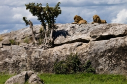
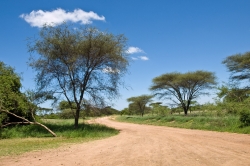
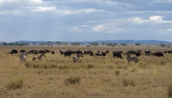
Serengeti Landscape
Beautiful Landscape of Serengeti
Photo by: epcp, Creative Commons

The Serengeti migration is a remarkable and impressive story. This migration takes place twice a year within Kenya and Tanzania and is considered one of the greatest migrations of wildlife on the planet.

During the month of October, almost two million herbivores travel from the northern hills to the southern plains. In April they return to the north by crossing the Mara River. This cycle is usually referred as the circular migration. The Serengeti is located in the eastern part of Africa.

The Serengeti is one of the ten natural travel wonders of the world. Its ecosystem is spread across 60,000 square kilometers. When the season changes, thousands of wild life, such as wildebeests and zebras, migrate to greener pasture for food and water. While migrating, some animals are able to make the journey and some die during the trip. When the animals are migrating, predators keep a close watch on them and seek out the weaker prey that can be killed for food.

The Serengeti has many national parks and animal reserves. Statistics show that the Serengeti has more than two million herbivores and thousands of carnivorous animals that take part in the migration. Some of the more common animals include blue wildebeests, gazelles, zebras and buffaloes.

The Serengeti migration is a treat for the tourists who love to be out in nature with wildlife. One can spend time in luxurious lodges and tented camps. There are well-guided nature walks and off-road tours in 4×4 vehicles. Going on a safari jeep expedition can give visitors close encounters with the animals.

Pictures & Photos

March 16, 2009 at 6:48 pm | 2 comments

Amber Fort Near Jaipur

Amber Fort From Higher Vantage Point
Amber Fort Taken From High Vantage Point
Photo by: closelyobserved.com, Creative Commons
Amber Fort and Lake
Amber Fort and Lake
Photo by: mckaysavage, Creative Commons
Elephant Ride That Takes You to Amber Fort
Close Shot of an Elephant That Takes Tourists to Amber Fort
Photo by: foxypar4, Creative Commons
Elephants Taking Tourists to Amber Fort
Elephants Getting Read to Take Tourists to Amber Fort
Photo by: foxypar4, Creative Commons
Inner Courtyard of Amber Fort During Monsoon
Photo by: mckaysavage, Creative Commons

Amber Fort, also known as “Amer Fort” is situated in Amber, located at 11 kilometers from Jaipur, North east of Rajasthan, India. It is considered as one of the best hilltops fort in India which makes it a major tourist spot in India. The fort is a typical example for Rajput’s life style in Rajasthan and it has a unique artistic style which combines both Hindu and Muslim elements. This magnificent fort is situated alongside the lake of Moatha and it was built by Maharaja Man Singh in the year 1592.

It is constructed using white and red sandstones imposing a defensive structure from outside. But from inside, it is marked differently with lavish interior by Mughal style of ornamentation. The walls of the fort are covered with frescoes paintings, which depict the scenes of daily life. Some other walls are designed with mosaics and minute mirror works which is absolutely royal. The fort is divided into four sections which can be accessed through large staircase available in the center of the fort. The main entrance of the fort called “Surajpol” leads to the main courtyard where the large staircase to the fort is located. The courtyard is called “Jaleb Chowk”. As we enter into the palace, there is a temple known as “Kali Temple” which is very renowned for the silver door and statue of silver lions.

According to legends, a king named Maharaja Man Singh used to worship Kali, a Hindu goddess of death and destruction. One day, Kali the goddess appeared in Maharaja Man Singh’s dream and ordered him to recover her statue to place it in a proper and appropriate temple. Maharaja did accordingly and created the temple.

Tourists can use the service of elephants to ride up to the fort from the bottom of the hill. The sound and light show should not be missed in the evening. The most awe-inspiring thing to observe is the Hall of Mirrors. Legends say that one candle was enough to light the entire hall of fort because of these mirrors. Amber fort is open from morning 9:30 to evening 16:30 IST. There are different prices tagged for admission, photography and video as well. The best way to reach Jaipur is by traveling through airlines from Delhi. Another alternative is the railway, which is well connected to the other parts of India as well.

India was the mother of our race and Sanskrit the mother of Europe’s languages. She was the mother of our philosophy, mother through the Arabs, of much of our mathematics, mother through Buddha, of the ideals embodied in Christianity, mother through village communities of self-government and democracy. Mother India is in many ways the mother of us all.
Will Durant quotes, American writer and historian

March 16, 2009 at 4:03 pm | 9 comments

Agra Fort in Agra

Agra Fort
Amar Singh gate displaying red sandstone walls from the Agra Fort
Photo by: laszlo-photo, Creative Commons

Agra Fort, also known as “Laal Kila”, is located in Agra, India. It is listed as a world heritage site by UNESCO in 1983. The fort is located at about 2.5 kilometers from the Taj Mahal, one of the Seven Wonders of the World. It was designed and built by the great Akbar, emperor of Mughal Dynasty, in the year 1565 A.D. Because of this impressive fort, Agra is renowned as walled Palatial City. Agra was the capital of India in the ancient times. This glorious fort is built alongside Yamuna River, a major tributary river in northern India. This is one of the most important buildings of Mughal dynasty made with Mughal style of art and architecture.

The fort consists of a wall with a height of 70 foot, built with red sandstone along with many buildings in the site. The wall has two gates, namely The Delhi Gate and The Amar Singh Gate. We can enter into the fort only through The Amar Singh Gate. After entering into the fort, on the very first sight, we can see the great courtyard. To the right hand side, we can see a hall of public audience with several pillars called “Diwan-i-am”, which was built in the year 1628 by Shahjahan, emperor of Mughal dynasty. As we go further, we see two beautiful mosques, palaces and a market called “Zenana Mina bazaar”. Most of the buildings inside the fort are made up of marble stone. The most impressive thing to observe is the walls in the buildings, which are filled with running water in order to cool the rooms in summer. We can say it as ancient A.C with ancient technology. The view from the pavilion balconies is so incredible that one will fall in love with the nature.

The best way to reach Agra is to catch a flight from Delhi, capital of India. The alternative way is to catch a train “Taj express” from Delhi (204 kilometers from Delhi). The Agra fort is open from sunset to sunrise. The admission fee is 300 Rs for those who are above twelve years and it also varies for the tourists coming from different countries.

However, this fort has been a wonderful tourist place from the ancient period enriched with its uniqueness. Start building you memories!

We owe a lot to the Indians, who taught us how to count, without which no worthwhile scientific discovery could have been made” -Albert Einstein

March 16, 2009 at 3:19 pm | 2 comments

Karnak Temple Near Luxor

Aerial View of Karnak Temple
Photo by: SonofGrouchu, Creative Commons

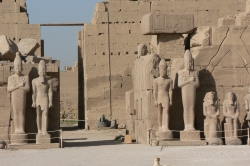
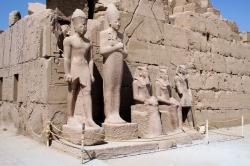
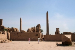
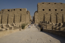
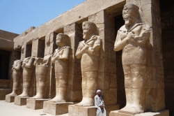
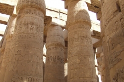
Karnak Temple is located in a small ancient village in Egypt called al-Karnak. The village is situated on the Nile river’s banks about 2.5 kilometers north from Luxor. The Karnak Temple is twice as big as the village area and has become the village’s most popular attraction. The temple is now an enormous open-air museum, as well as one of the biggest ancient religious sites worldwide. The Karnak Temple is Egypt’s second most visited site of historical value, next to the Pyramids of Giza.

The temple has four main parts, the largest portion is the only one which is accessible to the general public. Aside from the other three parts, there are a few other sanctuaries and temples located on the outside of the enclosing walls. There are also many statues of sphinxes with ram heads that connect the Precinct of Mut, the Luxor Temple, and the Precinct of Amon-Re.

The major difference between the Karnak Temple and many of the other sites in Egypt is how long the temple took to develop, as well as how long it was used. The construction of the temple started during the 16th century B.C. About 30 pharaohs gave a contribution to the buildings, which enabled it to reach a diversity, complexity, and size that is not seen anywhere else in the world.

Pictures & Photos

March 16, 2009 at 12:44 pm | 9 comments

Bora Bora in the Leeward Islands

Bora Bora
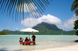
Sofitel Motu in Bora Bora with Mount Otemanu in background
Photo at: tensaibuta, Creative Commons

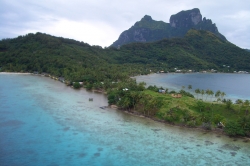
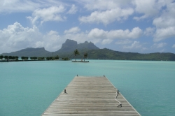
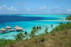
Bora Bora is an island within the Leeward Islands of the French Polynesia in the Pacific Ocean and is located about 140 miles northwest from Papeete. The island is completely surrounded by a barrier reef and a lagoon, which makes it a vacationing paradise for holiday travelers and tourists. At the island’s center, one can find remnants from a volcano that is now extinct and rises with two peaks, Mount Otemanu and Mount Pahia, where the highest point is 2,385 feet high. The original name of Bora Bora was given from the Tahitian language, which is better translated as Pora Pora.

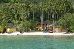
Bora Bora was first sighted in 1722, but then located again in 1769 and settled in 1777. Today, tourism is a big part of the island, where many resorts have been constructed on the small island that surrounds the lagoon of the Bora Bora. The first bungalows over the water were built about 30 years ago on stilts by the Hotel Bora Bora. Now the overwater bungalows have become a standard feature for most of the resorts on the island.

Most of the island’s tourist destinations are centered around aquatic activities, but there are still some attractions to see on land. Some of the aquatic activities include scuba diving and snorkeling around or in the lagoon. There are many species of stingrays and sharks that live in the water, and some of the diving operators actually offer tourists the chance to dive with the manta rays or feed the sharks.

Pictures & Photos

March 16, 2009 at 1:22 am | 19 comments

Banaue Rice Terraces in Ifugao

Banaue Rice Terraces
Clear and Sharp View of Banaue Rice Terraces
Photo by: jonrawlinson, Creative Commons

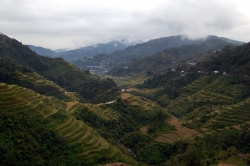
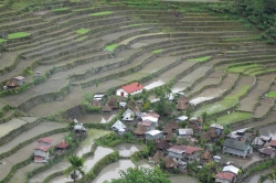
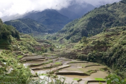
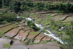
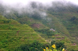
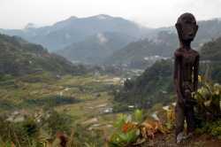
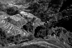
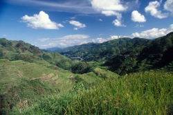
The Banaue Rice Terraces of the Philippines have been deemed the 8th wonder of the world. They were carved from the hillside by the tribes people of Ifugao about 2,000-3,000 years ago. The tribes people dug them out with their bare hands and crude implements. Doing so they created steps in the hills where they could plant their rice. The rice terraces are still used to this day.

The terraces are considered to be one of the greatest engineering feats of mankind. If each one were connected end to end, then they would reach halfway across the globe or be 10 times as long as the Great Wall of China. It was not until 1995 that the Banaue Rice Terraces were declared a World Heritage Site by UNESCO.

The rice terraces are like stepping stones stretching towards the sky. Some of them reach almost 5,000 feet in altitude and cover about 4,000 square miles of land. They are now beginning to show signs of erosion, and some of the terraces need maintenance. Many of the Ifugaos’ newer generations are migrating to nearby cities in search of better opportunities work opportunities as a result.

Even though it is about eight or nine hours from Manila traveling by car, the Banaue rice terraces are known to be one of the most spectacular places to see in the Philippines. They have transformed the Cordillera mountains’ barren stone into ledges that are fit to grow rice.

Pictures & Photos

March 15, 2009 at 2:46 am | 29 comments

Chichen Itza in Yucatan Peninsula

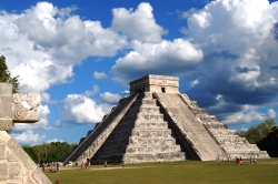
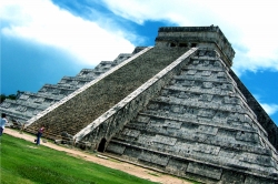
Kukulcan Temple at Chichen Itza
Kukulcan, the Main Temple at Chichen Itza
Photo by: kyle simourd, Creative Commons

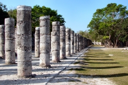
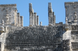
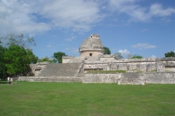
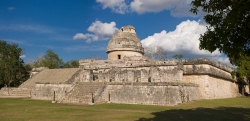
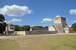
Chichen Itza was founded by the Maya in 400 A.D. and is located in the north central Yucatan Peninsula, now called Mexico. Chichen is located 75 miles from Merida and has a history of 1500 years. It was the primary location for different ceremonies and is believed to have been governed by priests. Chichen Itza means “At the mouth of the well of Itza”. The word Chi stands for ‘mouth’, Chen for ‘well’ and Itza for ‘the Itza tribe’. The people who lived there are believed to have sacrificed objects and humans to their god. Those who survived the ordeal were thought to be seers.

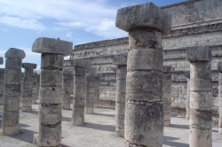
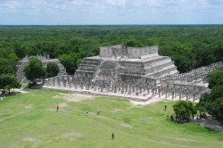
The site contains many buildings and temples of stone in various stages of preservation. The site is built in different architectural styles that show a cultural mix of Mayan and non-Mayan civilization. The Chichen Itza site has three divisions in total: the north, central, and south groups. One group is in the Toltec style, and the others give an idea about the Chichen Itzan culture. Since the site is one of the most famous Mayan Pyramids, it has been thoroughly researched by private agencies.

Chichen Itza is now a federal property maintained by Mexico’s national Institute of Anthropology and History. The best time for site seeing is either early morning or late in the afternoon.

Pictures & Photos

March 14, 2009 at 9:58 pm | 16 comments

Basilica of San Vitale

San Vitale Basilica
View of San Vitale’s Basilica From Outside
Photo from: Wikipedia Creative Commons
San Vitale Basilica's Ceiling
Basilica of San Vitale’s Ceiling
Photo from: Andy Hay Creative Commons
Interior of San Vitale Basilica
Basilica of San Vitale’s Interior Dynamics
Photo from: Seier Creative Commons

For I dipped into the future, far as human eye could see, saw the vision of the world, and all the wonder that would be” – Alfred, Lord Tennyson

Location
Basilica of San Vitale is most famous monument located in Ravenna, Italy.

Uniqueness
It is popular for Byzantine art and architecture in the whole Western Europe. The monument is one of the eight Ravenna structures which are listed in UNESCO world heritage. Basilica of San Vitale is famous for  its wealth of Byzantine Mosaics and also most preserved from the period of Emperor Justinian.

History
The church actually began in the year 527 AD by Bishop “Ecclesius” when the city of Ravenna was under the rule of the Ostrogoths and completed in the year 548 during the rule of 27th Bishop “Maximian”. The architect of the church is still unknown, but it was certainly one of the best architecture of that time. The construction of Basilica of San Vitale was sponsored by Iulianus Argentarius, a Greek banker. The total cost spent for the construction was about 26,000 gold pieces.

Structure
The Basilica of San Vitale has an octagonal plan which combines the Roman elements like the dome, stepped towers and shape of doorways with Byzantine. The central part of the church is surrounded by two superposed ambulatories (a place of walking). All the mosaics depict the Hellenistic-Roman tradition which looks lively and imaginative due to rich colors.

Events
The Basilica of San Vitale conducts several events through out the year. Some of them are:

• Ravenna Festival
• Mosaico di Notte
• Antiques Market
• Alighieri and Rasi Theaters

Visiting guidelines
There are two combo tickets to Ravenna which even includes Basilica of San Vitale. There are no individual admissions for the sights in Ravenna. The total admission ticket fee is €8.50 which is sold at the sights. The admission is open from morning 9:00 am to evening 5:30 pm. Photography is allowed in the church. Please note that there is a replica of Basilica of San Vitale within the city of Rome. But the one which is notable and outstanding is the Basilica of San Vitale, Ravenna.

March 12, 2009 at 3:13 am | 2 comments

Pantheon

Pantheon Facade
Pantheon Facade in Rome, Italy
Photo by: truello, Creative Commons
Crowd Inside Pantheon
A Big Crowd Inside the Dome
Photo by: Wili_hybrid, Creative Commons

The Pantheon is a building in Rome which was built as a temple of all the gods of ancient Rome. Pantheon in Latin means “temple of all gods”. The Pantheon is the best preserved building in comparison to all roman buildings and it has been uninterrupted since 2nd century AD. Pantheon holds the record for the largest non-reinforced dome in the history of architecture. Originally, Pantheon was built as a roman temple, but later it was converted to a Catholic Church. The most amazing thing to know is that the height to the oculus and the diameter of the interior circle are the same (43.3 meters).

The original Pantheon was built in 27 B.C., but due to the huge fire, most of the buildings got destroyed along with Pantheon. The Pantheon building which we see today was actually reconstructed in 125 A.D, during the reign of the Emperor Hadrian. Pantheon was totally reconstructed with the text of original inscription on the bricks. Before the current Pantheon, there were two other buildings occupying same site. The very first building was traditional rectilinear, t – shaped structure which was built in 27 B.C by the emperor Marcus Agrippa who is a son-in-law of Emperor Augustus. The temple was dedicated to the gods, Mars and Venus. The most important problem faced by Romans during its construction was the massive weight of the large dome. The huge columns of Pantheon were brought from Egypt which weighed 60 tons. The Pantheon contains the tombs of Raphael and of several kings of Italy.

The Pantheon building is ring-shaped with three ranks of huge granite pillars under a space into the rotunda under a coffered, solid dome, with a central opening (oculus), the Great Eye, open to the sky. Orthogonal building loops the portico with the rotunda. Though often still drawn as a free standing building, there was a building at its rear into which it is adjoined; of this structure there are only archaeological remains.

Pantheon Night Shot
View of Pantheon at Night
Photo by: yeowatzup, Creative Commons
Tha Pantheon From II Vittoraino
View of The Outside of Pantheon’s Dome From II Vittoraino
Photo by: dave hamster, Creative Commons

Open:
Monday-Saturday: 8:30 am – 7:30 pm
Sunday: 9:00 am – 6:00 pm

Fees: Free

Rome Famous Landmarks

March 10, 2009 at 6:55 pm | 7 comments

Palatine Hill

Palatine Hill
Palatine Hill in Rome, Italy
Photo by: permanently scatterbrained, Creative Commons

The Palatine Hill is one of the Seven Hills of Rome and it is the centerpiece hill which is one of the most ancient parts of the city. The name “Palatine” is derived from a Latin word “palus” which means marsh or swamp. The Palatine Hill is the place where the rich and famous Romans used to live. It is about 70 meters of height if viewed from Roman Forum from one side and the Circus Maximus from the other side. The Hill is a large open air museum which is most visited by tourists during the day time and it is situated between The Velbrum, the Circus Maximus and the Roman forum.

According to the mythology of Romans, the Palatine hill was the location of a cave called  “Lupercal “where Remus and Romulus were brought in by a she-wolf which kept them alive. The legends state that Faustulus, who is a shepherd, found them as infants and his wife brought them up and raised them. So later when Romulus grew older, he decided to build a city on Palatine hill. The hill was also a site to celebrate “Festival of Lupercalia”. Romulus chose this hill as a ideal spot to build a new city. Therefore, it was on this Palatine Hill where the Roman era of empires started.

All parts of the Palatine are not accessible to tourists, but the spots like Imperial Palaces, the Farnese Gardens and the House of Livia can be visited. The Palatine is open daily from morning 9:00 am to evening 7:00 pm with an admission fee of 9 Euros. The best way to reach Palatine Hill is to catch a metro to The Colosseum. The Roman Palatine Hill, which in existence may disappoint as the ruins are minimized due to age, but the view is fantastic to experience.

Rome Famous Landmarks

March 10, 2009 at 5:44 pm | 1 comment

St Mark’s Square

St Marks Square
View of St. Mark’s Square from Campanile looking down.
Photo from: Joe Creative Commons

St Mark’s Square often known as “Piazza San Marco” is the principal square located in Venice, Italy. It is one of the most visited and photographed attractions in Italy. St Mark’s Square is also termed as “the drawing room of the world” which conveys perfect impression of city’s culture and architecture history.

The city originated in the ninth century as a small area in front of a cathedral church “St Mark’s basilica”. St Mark’s Square is the heart of Venice as it is located on the banks of the Grand Canal. Politically, St Mark’s Square has been a very important place for the people living there and it was enlarged to its present size and shape in the year 1177. It was an important and strategic location for the offices in the Venetian state since nineteenth century. As we go through the square, we find two columns where there are two symbols of Venice namely St Mark’s lion and the statue of St Theodore along with the patriot saint of Venice. The St Mark’s Square was used for public meetings the square is now filled with pigeons and thousands of tourists all over the world. St Mark’s Square is surrounded by the buildings called “Procuratia” which consists of offices and apartments of officials in the Venetian government. Campanile, a watch tower with a height of 314 feet was built in the ninth century, which Galileo used for his work. This watch tower collapsed and was rebuilt in 1902.

St Mark’s Square is covered by arcades on three sides and St Marks church on the eastern side. During the daytime, its filled up lots of visitors, pigeons and continuous music playing around the area. One can spend a complete day with complete satisfaction. We can see a huge number of visitors feeding the pigeons which is a major activity around the square and tourists can purchase the packets of corns from the vendors situated around. Recently, the government has passed a law to ban feeding the pigeons as they cause damage the Mosaics on St Mark’s Basilica and to the other buildings of square. St Mark’s Square has full of life and history surrounded by the major sights of Italy and it should not be missed.

March 10, 2009 at 2:59 pm | No comment

Positano on the Amalfi Coast

Positano Beach
Beautiful Spot at Positano Beach
Photo from: Allerina & Glen MacLarty Creative Commons

“It is a dream place that isn’t quite real when you are there and becomes beckoningly real after you have gone.”Steinbeck

Positano is a small town located in Campania, Italy. It is situated on the coastal line called Amalfi Coast. The beauty part of this city is situated on the hill leading down to the coast and it is the most luxurious and romantic spot in Italy. Positano was built vertically on the face of the mountain. Initially, Positano began as a fishing village and later on, the town became famous for writers and artists. This small town has many high class boutiques and it is also a great place to purchase sandals and footwear which are exclusively made in Positano. As there are many lemon trees in Amalfi coast, Limoncello (a lemon alcoholic drink) is popular all over the world. By the sea side, we can shop and have a nice sea food meal along the Spiaggia Grande. The coast of Positano is always crowded with a lot of visitors swimming in the crystal clear waters and catching some sun on the beaches. Santa Maria Assunta, a famous Positano church has a beautiful ceramic dome can be viewed from many places.

According to the legends of Positano, an icon was stolen by the Byzantium which was being transported across the Mediterranean by the pirates. A horrifying storm began in the sea and pirates heard a voice saying “posa! Posa!” which means “put down”. The sailors got frightened and unloaded the precious icon to the fishing village. Positano has many beautiful buildings, palaces, and villas along with eight defense towers which were built in the 16th century.

The best way to get around Positano is by walking. If we use the bus facility, we reach the top of Positano called the thousand steps. There is a bus along the main street which takes down to the beach. From Positano, one can visit beaches, villages and countryside using pedestrian zone. There are also water and car taxis available to reach the beaches and villages. The nearby airport to Positano is Naples international airport. The road which leads to Positano from Naples is difficult to drive. Therefore, I suggest the readers who are interested in visiting Positano to avoid traveling by a car.

Today, Positano has become a major attraction for tourism due to its beaches and seafoods. A well renowned magazine “travel+leisure” had published the results of its 11th annual poll for best traveling hot spots and Positano stood in the 30th position.

March 10, 2009 at 2:02 pm | 1 comment

Roman Forum

Roman Forum
Nice View of The Roman Forum
Photo from: wikipedia, Creative Commons
1904 Map of the Roman Forum
Map of the Roman Forum, from Samuel Ball Platner’s
The Topography and Monuments of Ancient Rome (1904)
(altered for clarity)

even if the wounds of this shattered world enmesh you, and the sea in turmoil bears you along in but one surviving ship , it would still befit you to maintain your enthusiasm for studies unimpaired .why should lasting values tremble if transient things fall
Prosper of Aquitaine

The Roman forum is located in between the Palatine hill and Capitoline hill in the center of Rome. It is one of the most popular and most visited sights of Rome and it is also sometimes known by its original name “Forum Romanum”. It is the main area where the ancient roman civilization was developed. The Roman forum was the political and economic centre of Rome during republic. Citizens of Rome sometimes refer the location as “Forum Magnum “or sometimes just “Forum”. The important and the oldest structures of the ancient Rome city are located inside the forum which also includes royal residence “The Regia” and a complex “Vestal Virgins”.

The Roman forum was covered with grass but the Romans drained the area to make it as the center of social and political activity. The forum was expanded to include temples, law courts and a senate house. After the end of roman period, the forum was destroyed and use as a cattle pasture during the Middle Ages.

The forum consists of a statue of Julius Caesar along with many temples, buildings and arches. The important places which are mostly visited by the tourists are:

• Temple of castor and Pollux
• Temple of Saturn
• Temple of Vesta
• Temple of Venus and Roma
• Temple of Antoninus and Faustina
• Temple of Caesar
• Temple of Vespasian and Titus
• Temple of concord
• Shrine of Venus Cloacina
• Basilica Aemilia
• Basilica Julia
• Basilica of Maxentius and Constantine
• Arch of Septimius Severus
• Arch of Titus
• Arch of Tiberius
• Arch of Augustus.

Traveling to Roman Forum

The best way to reach to The Roman forum is by traveling through bus lines from Colosseum metro stop. The admission fee to enter into the Forum is 11 euros and the forum is open from morning 9:00 am to evening 7:00 pm.

History studies not just facts and institutions; its real subject is the human spirit

Rome Famous Landmarks

March 10, 2009 at 4:13 am | 4 comments

Nintoku Mausoleum

Nintoku Tomb Front Gate
Front Gate of Nintoku Mausoleum
Nintoku Mausoleum
Aerial View of Nintoku Mausoleum
“National Land Image Information (Color Aerial Photographs),

Nintoku Mausoleum is the largest Mausoleum (external building or burial chamber constructed as a monument) in Japan. The Nintoku Mausoleum is considered as one of the three largest tombs in the world and it is located in the city of Sakai, southeast of Osaka, Japan.

The Mausoleum was built in the 5th century in the name of Emperor Nintoku on a larger scale than the Pyramids of Egypt. The construction of Nintoku Mausoleum took about twenty long years with a total work force of about 800,000 laborers. The site of Nintoku Mausoleum covers about 1.3 million square feet. The tomb of Nintoku in Nintoku Mausoleum is surrounded with three moats and pine, cypress trees and cedar. The structure is in the shape of keyhole with overall length of 486 meters, 35 meter height and a total area of about 460,000 square meters.

The easiest way to reach the Nintoku Mausoleum is to catch JR Hanwa line and to drop down at Mozu station. From Mozu station, a walk of five minutes is required to reach the mausoleum. Admission to the inner area is not permitted, but the visitors are permitted to walk around the outer moat which gives an idea of Nintoku Mausoleum and the grounds. One should definitely witness this kind of Mausoleum at least once in a life time as the architecture is a master piece of its own kind.

March 5, 2009 at 9:12 pm | 2 comments

Hakone Lake District

Hakone Gardens
Hakone Gardens With Exposure Blend
Photo by: chadh, Creative Commons

Hakone is a town in Kanagawa prefecture located on the eastern foot of Hakone pass. Hakone lake district has a reputation as one of the best holiday resorts of the world around the year and it has about twenty different qualities with nick name “Hakone Seventeen Spas”. In addition to spas, Hakone is also a home to various museums and large historical zone.

Hakone is a fantastic holiday spot which has population of just about 14,000 people. The total area of Hakone is 93 square km. There is also famous check point called “Hakone Checkpoint” which was actually renamed from “Ashigara Check Point” after the Edo period. The Hakone barrier was built on the Tokaido highway in 1619 to maintain peace with foreigners from the west. Due to this reason, Hakone barrier is called “the border between the east and the west” and it used to terrify the travelers passing through because of heavy inspection before passing through.

The major attraction in Hakone is Hakone Ropeway which starts from Lake Ashi along with Mt. Fuji. Apart from Hakone Ropeway, there are numbers of spots to visit such as O-Waku-Dani, Lake Ashi–No-Ko, Susukio-Sogen of Sengokuhara, Moto-Hakone, and the alpine trees along Kyu-Kaido Street. There are various methods of transportation to travel from one place to another including cruising boat and cable car. In addition to these, Hakone has various museums such as The Hakone Open Air Museum, The Narukawa Art Museum, The Pola Museum and The Venetian Glass Museum which are always crowded by the visitors around the world.

Traveling to Hakone Lake District

There are two main ways to reach HAKONE from Tokyo.

If planned by bus: SHINJUKU TERMINAL (ODAKYU EXPRESS BUS [97 MINUTES])

If planned by train: JR TOKAIDO LINE [35 MINUTES]

March 5, 2009 at 8:15 pm | 1 comment

Ginza at Night

Scenery Shot From Cafe
Scenery Shot From Cafe at Night in Ginza
Photo by: OiMax, Creative Commons
Ginza Overview
Aerial View Over Ginza at Night
Photo by: br1dotcome, Creative Commons

Ginza is an amazing place in Chuo, Tokyo and it is popularly known to be an up market area of Tokyo consisting of many department stores, shopping malls, restaurants and coffee houses. Ginza is said to be one of the luxurious shopping destinations in the world with it stylish looks, modern atmosphere and technology. The most impressive thing to observe here is neon lights during the night time. During the night, the typical Neon lights signs showcase luxury brands. Ginza at night looks amazing and very attractive and is almost as bright as day.

Center Shot of Ginza
Great Perspective Shot of Ginza During the Night
Photo by: OiMax, Creative Commons

Ginza was established in the year 1612, the Edo period during which silver coin mint was named. Modern Ginza started from the year 1872 after the rebuilt of several buildings which got damaged due to devastating fire. The whole district was re-built using the Irish technology. The most famous and popular buildings to observe are Sony building , Mitsukoshi Departmental Store , Apple Store , Kabuki-za Theatre, Tsukiji Honganji,  Tsukiji Fish Market, and Nakajin Capsule Apartment Building. Many international brands apart from Gucci, Sony, etc… can be found around Ninza. Jewelry shops are found in plenty along with the designer boutiques and top flight department stores around Ninza area. The shops are kept open until 8 pm, which gives a chance to visitors to enjoy the shopping and the sight seeing.

The best and the easiest way to reach Ginza is to catch a Ginza sub-way line (Tokyo metro Marunouchi line), which starts from the center of Tokyo. The journey is approximately two minutes and the minimum fare is 160 Yen. Experiencing Ninza is really fun for those who like a little bit of culture and are able to afford the luxury. Everything here is expensive, if you are planning to do some shopping and experience some food, make sure you have enough money to get yourself home.

Ginza Center Streets View
Street Views of Ginza From the Center
Photo by: heiwa4126, Creative Commons

Tokyo Famous Landmarks

March 5, 2009 at 8:53 am | 2 comments

Osaka Castle

Osaka Castle
View of Osaka Castle’s Main Tower
Photo by: JoopDorresteijn, Creative Commons

The Osaka Castle is one of the famous castles located in Japan and it was built in 1583 by Toyotomi Hideyoshi. The tower at Osaka’s castle is used as storeroom. The castle is constructed on a platform standing on the walls supported on a rock. The castle at the center is of five stories from outside and eight stories from inside and it was constructed on a high stone in order to safeguard from enemies.

Size and Construction Plans

Osaka Castle covers an area of about 15 acres, among them, the Japanese government has declared thirteen structures as ancient cultural property which also includes Toyokuni Shrine. In the year 1583, Toyotomi Hideyoshi started the construction at Ishiyama Hongan-ji temple site. Toyotami first thought of constructing castle that mirrored Oda’s, but it never happened. The idea of the building was changed later to construct a five stories and three more stories below it, and a gold leaf was placed on the top of the tower. In the year 1585, the inner tower was constructed and later the castle was expanded making it stronger to withstand attack over it. In the year 1598, Hideyoshi died, at the same time, the construction of the castle was completed and later on, the castle was handed over to Hideyoshi’s son, Toyotomi Hideyori.

Floors Plan

In the castle, the main entrance makes a way unto ground floor. The building is a eight floored Museum which is held in reverse mode i.e., starts at last floor and ends at 2nd floor. There is also a mini theater in 1st floor. As per Osaka’s castle, the 8th floor comes first. This floor consists of some colored paints and also Naniwa port can be viewed from this floor. In the 7th floor during the rule of Toyotami Hideyoshi, history at that time of the Osaka castle can be seen. At the walls in the 7th floor, Hideyoshor, the display pictures of Hideyoshi can be seen. And moreover in this floor, Osaka Castle history is elucidated and also changes happened under the rule of Hideyoshi can also be seen. The next floors i.e.,5, 6th floors shows the ending rule of Toyotami and rise of Tokugawa, and that period was known as transition period. This period shows the battle between the families for gaining power. The last floors i.e.,3rd, 4th floors shows the materials during the reign of Hideyoshi Toyotami and also the stages of Osaka Castle during the time of Toyotami and Tokugawa. There are more than 8000 artifacts displayed here, the life of Hideyoshi Toyotami is also shown here.

Changes Through Time

During the battle by the Toyotami forces, the Osaka castle was damaged heavily and again it was rebuilt by Tokugawa. In the year 1660, the castle was severely burned as the gunpowder exploded causing a severe damage to the tower. Again in 1925, the tower was brought back into existence, and again in 1945 bombings damaged the restored tower, the government restored it back in 1995 and in 1997 it was brought back to existence again. The Osaka castle is now a famous tourist attraction and it is open to the public.

March 3, 2009 at 8:44 pm | 10 comments

Nijō Castle

Nijō Castle
One of the Building at Nijo Castle
Photo by: mhaw, Creative Commons

The Nijo Castle was built in 1601 by Tokugawa and it is located in Kyoto, Japan. Tokugawa constructed this castle as his residence. A little bit of structure from Fushimi Castle was added in 1623 by Iemitsu, the grand son of Tokugawa. The castle covers an area of approximately 8000 square meters, of which the buildings occupy the major part. The castle consists of huge stone walls and heavy gates and it is said to be a perfect example to display the architecture of that time.

In the year 1601, the feudal lords were asked donations for the construction of Nijo Castle by Tokugawa at that time. During the reign of Iemitsu, the grandson of Tokugawa, the construction of the castle was completed in 1626. Some parts of the main tower, Kara Gate, and Fushimi Castle are included in the castle. In the year 1788, a fire in the city struck, causing the inner part of the palace to be destroyed. The place stayed vacant up to 1893 when it was changed into an imperial palace.

The castle consists of two fortifications, one is known as the inner walls and the other is the outer walls. Honmaru palace is situated within the inner walls, along with its garden. The Ninomaru Palace, the gardens, the kitchens, and guard house are situated between the two main fortifications.

The Ninomaru Palace comprises of five buildings with an architecture that includes furniture and gold leaf. The architecture not only impresses the visitors, but also show the pride and honor of the kings. This castle is a fine example of arts and architecture at that time. The palace also consists of several reception rooms and quarters. The palace called Honmaru Palace also belongs to the castle. It covers an area about 1600 square meters. The palace has been divided into four parts. There is a living quarters inside where the Shoguns used to live, and recreation areas are provided. The present body of the palace is said to be Katsura place. There is also a large pond at the garden.

The castle also contains gardens, which are located in between the fortifications. The gardens at the castle are huge which contain plum as well as cherry trees. In the year 1939, the castle was gifted to Kyoto, and the next year it was opened to everyone.

March 3, 2009 at 6:43 pm | No comment

Nanzen-ji Temple

Sanmon at Nanzenji Temple
Sanmon, the Main Entrance of Nanzen-ji Temple
Photo by: laszlo-photo, Creative Commons

The Nanzenji temple is a Zen Buddhist temple, which is regarded as one of the most famous temple in Kyoto, Japan. Among the Zen temples in the Japan, this temple occupies a unique place. This temple comprises of 12 other temples, of which few temples can be viewed. There are several gardens along the temple premises.

The Nanzen-ji has got its history since 1291. At that time, the Kameyama emperor has called a priest named Fumon to his palace to get rid of an evil spirit that was in the palace. In spite of doing chanting, the priest Fumon meditated by sitting down in the palace, forcing the evil spirit to leave from the palace. Impressed with his work on meditation, the emperor granted the lower palace for the Zen temple.

The emperor used the upper palace to reside, whereas the lower palace is made a Zen temple, run by Fumon. In September 1393, warrior monks attacked the temple causing it to burn. In 1447, the temple was again set on fire and was again restored in 1467. In the year 1597, Toyotomi Hideyoshi restored the building and a Buddha hall was gifted along with the temple. Also, the Nazenji temple has been allotted with some land.

The temple comprised of 62 other temples in the period of 1616 to 1868. At the entrance, there is a gate which is known as San-mon. In Japan, this gate stood as number three and it was constructed in 1296 and demolished in 1447. In 1616, the gate was built again and it was dedicated to the dead soldiers in 1616.

This temple attracts a lot of people and only a few temples can be visited. The Zen garden here is a great place for the public and it contains three rock tigers followed by three rock cubs. The place of interest at this place is the Tenjuan temple and people can visit this temple during spring and autumn seasons. Also, the Tenjuan gardens has a great view that contains white sand and waterfall. Though as a temple, it provides a great scenic beauty for the people.

March 3, 2009 at 6:13 pm | No comment

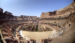
Colosseum

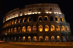
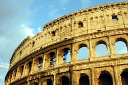
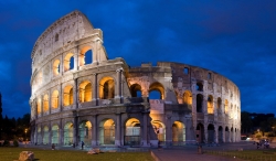
Colosseum of Rome
Colosseum of Rome Upper View
Photo from: Malkav Creative Commons

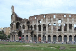
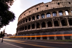
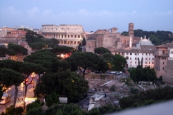
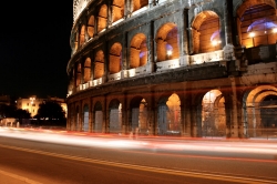
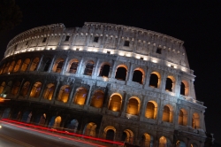
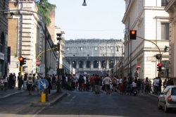
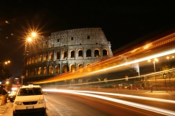
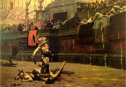
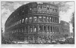
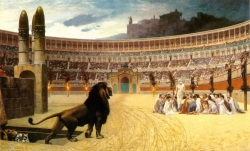
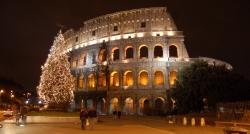
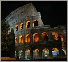
The Colosseum is one of the greatest architectural accomplishments in the history of Rome. It was originally known as the Flavian Amphitheatre and it is the largest amphitheater in the world. The Amphitheater was built to organize gladiator contests, animal hunts, dramas, and battle re-enactments. All of these were attended by the people and most of the entertainment was sponsored by a private party.

Built in the center of Rome itself, the Colosseum’s construction began sometime between 70 and 72 AD and was completed in 80 AD under the reign of Emperor Titus. It has a seating capacity of 50,000 spectators, and over the years has been damaged by natural disasters such as earthquakes and fires. Many restoration projects have updated and restored the Colosseum, but pollution and traffic continue to damage its interior.

Today, the Colosseum is used for multiple purposes. The Pope leads a procession on good Fridays called the station of the cross, and political organizations light the walls with gold light when capital punishment is abolished in countries around the world. The Colosseum of Rome has been given great importance by the media and various Hollywood movies have been shot in the amphitheater. The famous movie “Gladiator” was highly influenced by the Roman culture and the gladiator contests.

Traveling to the Colosseum

The fascinating history involving bloodbaths and battles associated with the structure is what draws visitors to this historical site. Getting to the Colosseum by taxi or bus from the airport is easy enough, but the line to get into the site itself can be long, especially during the very busy summer season. Aside from going there at any other time, there are other ways to get around these long lines. You can buy your ticket either at the Roman Forum or the Via de San Gregorio (these ticket counters are usually line-free), or you can even get them online. You can also buy a combo ticket that covers several of Rome’s main attractions, or call the office to reserve your ticket in advance. Another good way to avoid long lines at the Colosseum entrance is by joining a tour group.

Pictures & Photos

Rome Famous Landmarks

7 Wonders of the Medieval World

7 Latest Wonders

March 3, 2009 at 2:01 pm | 18 comments

Tiananmen Square in Beijing

The mention of Tiananmen Square might transport many of us into the protests that took place in the heart of Beijing (capital of China) in 1989. Initiated by the university students and some intellectuals, the Tiananmen Square massacre is remembered for the courage students showed in front of the Communist government.

Tiananmen Square
Panorama View of Tiananmen Square at Beijing
Photo from: Saad.Akhtar, Creative Commons

However, as it stands today, the Square presents a picture perfect look. Tiananmen Square spans across the sprawling 44,000 square meters. The captivating national flag of China is hoisted here which is a sight to behold with the historical monument in the background. No wonder the place has become one of the most popular tourist sites in the entire country giving glimpse in the history, politics and other aspects of China. Located on the north end of the Square is Tiananmen Tower, in the center is the impressive granite Monument to the People’s Heroes. In the east is the National Museum of China and as one move towards the west is the Great Hall of the people and Mao Zedong Memorial Hall is in the south.

Built in 1917, the towering Tiananmen Tower was earlier used to announce to the public when any new emperor was sworn in. The investiture ceremony was usually held in the Tower only. The Monument of the people’s Heroes has epigraph written by Mao Zedong (the first Chairman of Republic of China) which epitomizes the spirit of the monument built in 1977. The tower has five gates and nine principal columns with exquisite carvings and the river Jinshui flowing under it.

Made in 1959, the Great Hall of the People is a very significant building. A magnificent structure, it occupies the area of 170, 000 square meters. It is here that the remains of Mao Zedong are kept. It has three halls: Main, North and South Hall. China National People’s Congress meetings are held here besides being the hub of other political and diplomatic activities.

Opened to the pubic in year 2003, The National Museum of China is a store house for information about the Chinese history.

March 3, 2009 at 8:52 am | 2 comments

Tiger Leaping Gorge on the Yangtze River

Tiger Leaping Gorge
Up Close View of the Water Current at Tiger Leaping Gorge
Photo from: Livepine, Creative Commons

Tiger Leaping gorge is located between Yulong snow mountaiun and Haba snow mountain which is about 100 kilometers northwest of Lijjang old town. The gorge is believed to be the deepest valley between the two cliffs in the world. Tiger Leaping Gorge is rated as the worlds number one contestant for the deepest river valley. At the entrance of the gorge, you will find the flowing gold sands of the River Jingsha. This river is about 30 meters wide with fantastic frothing surface.

Spring season is the best time to visit this splendid greenery adventurous spot. Tiger Leaping Gorge is defined as the worlds deepest river-gorge in the world for its death defining depth of approximately 3000 meters from lateral sides of the mountains. The birth of ancient Lijing culture took place in Tiger Leaping Gorge and the Lijing people lived in valleys and caves of Yulong and Haba mountains for many generations. The Tiger Leaping Gorge resembles the culture, resources and traditions of the ancient Lijing people. There are rock paintings in some of the caves of Yulong mountain which resembles the ancient culture.

Tiger Leaping Gorge is divided into three different sections, the first section is the uppermost section with narrowest flow of Jingsha River. This river flows continuously with charming foam and with huge sounds. Jingsha river gets down to 100 meters with increase in incredible speed of flow rate in the middle section the of Tiger Leaping Gorge. This is the place where the water smashes into the large sharp rocks and return back in to the charming foam river forming a whirling motion . This scenic spots makes us feel like heaven.

In the middle section of the gorge, there is a large rock 30 meters wide, positioned at deep narrowest section of the gorge. It is believed that in the past, there was a tiger which used this rock as a stepping stone to leap from one end to the other end . That’s why this gorge is named as “Tiger leaping Gorge”.

The cliffs of the tiger leaping Gorges are more dangerous and much steeper with a sharp inclination angle. This angle makes the Jingsha river turn and twist with intense force of energy forming high tidal waves, as it makes direct impact with the mountain edge. This scenic view gives us a adventures feel and also fulfills the desire of boat rafting. The tiger Leaping gorge expands up to 16 kilometers, which helps the tourists by providing the possibility of boat rafting and drifting. Boat rafting is an adventurous and breathtaking event in the Tiger Leaping Gorge.

Tiger Leaping Gorge is the best place for tourists to go on an extended walk for pleasure. There are 2 ways to reach the gore: one is from Lijing old town, which takes at least two days to climb up the uppermost path of the gorge and the other path starts from Ganhaizi, which is located in Yulong snow mountain. This path takes you to the Lower range of the Tiger Leaping Gorge. This beautiful scenic spot is full of breath taking activities and tons of excitement for the adventurous personality.

March 3, 2009 at 8:02 am | 2 comments

Big Wild Goose Pagoda in Xian

Giant Wild Goose Pagoda
Big Wild Goose Pagoda, AKA Giant Wild Goose Pagoda
Photo from: wikipedia, Creative Commons

Big Wild Goose Pagoda or Giant Wild Goose Pagoda is located in Ci’en temple in the southern province of Xian city. The construction of the Big Wild Goose pagoda brings a spectacular awesome wide view of physical space. It is a square brick-laid construction with the height of 64 meters with seven stories of side length carrying 25 meters and it is also decorated with specially designed spiraling stairs and arch doors for four sides of the stories. It is rated as four star rating for its tourist attraction, it attracts great number of individuals for its name and fame in the religion of Buddhism. The Buddhist materials were stored in this ancient building and worshiped as it is a holy place for the Buddhists.

Tourism

The main tourist attraction for the Ci’en temple is the presence of Big Wild Goose pagoda. It brings the name and fame for the Chinese culture and tradition. The Ci’en temple is the entrance area of the Big Goose Pagoda constructed in the fond memory of moral excellence queen.

Construction – When, Who, and How it was Built

Big Wild Goose pagoda was constructed during the reign of the Tang Dynasty Emperor named Gaozong in the 618-907 period. From that period, the ancient building used to collect and preserve all the Buddhist materials from India by the hierarchy of Xuanzang. Xuanzang was a scholar, traveler, translator and a famous Buddhist monk during The Tang Dynasty. He traveled to India, birthplace of civilization of Buddhism. He stayed for 17 years and traveled across more than 100 countries to obtain Buddha sutras, figures and relics. Later he became the superior of a monastery of Da Ci’en temple by the Tang dynasty in the period 628-683. He ordered the heirarchs to translate all Sanskrit sutras into Chinese language which was totaling around 1,335 volumes. He governed the building of pagoda in preserving the memorable Buddhists civilization history.

Big Wild Goose Pagoda was first constructed with five stories with a height of 60 meters and later it was reconstructed with additional 2 stories with total height of 64.5 meters. It is simply defined as the masterpiece of Buddhist civilization. It was constructed with square brick so it looks like a square cone and the spiraling stairs brings extravagant beauty for the visitors in viewing the Xian city from the seven stories building. The walls of the Big Wild Goose pagoda are well engraved with the statues of Buddha by the world most renowned artist Yan liben.

History

According the ancient belief of Buddhist, there was a story for building the Big Wild Goose Pagoda. In the ancient times, there were two branches, for one of them, eating meat is not a ban and for other it was ban in the society. One day, there was no meat in the town to eat. At that time, a monk saw a big wild geese flying by, he then prayed to Buddha to give some meat to eat and then immediately all the monks were shocked during that moment due to flying goose fell down to the ground with broken wings. This moment made them realize the importance of bodhisattva to be more marked by conspicuous devoutness. In that place where the goose fell, the monks established a big pagoda and named it as Big Wild Goose Pagoda and it is noteworthy to know the traditions and cultures of the Chinese people.

March 2, 2009 at 6:22 pm | 1 comment