

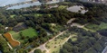
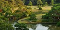
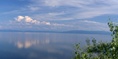
Sunset View of West Lake


West lake is located in Hangzhou, the most famous tourist venture spot in china and it is defined as China’s most elegant nature lake. West Lake is also defined as “Paradise on Earth”. It takes three and half hour’s drive from Shanghai to Hangzhou City. Hangzhou is the biggest tourism venture spot in the Yangtze Dynasty because of West Lake. It is the best place on earth to spend leisure time. West Lake also represents the beautiful legendary track of Chinese history, artistic work, culture and literature. It has a vast landscape of 5.6 square kilometers in an elliptical shape with attractive scenery shots. West lake is divided into different spectacular spots by Su Causeway, Bai Causeway and Yanggong Causeway.
Best Scenery Spots Of West Lake:
West Lake Spring Dawn at Su Causeway: Spring Dawn at Su Causeway is the spot visited the most at West Lake. The name Su Causeway was given in fond memory of Su Dong Po , the governor of Hangzhou. Su Causeway landscape is around three kilometers with all six arch bridges named as Ying Po, Wang Shan,Yia Ti, Dong Pu and Qua Hong. Each bridge has its own uniqueness in defining the nature beauty and also reveals the poetic feel of the nature to every visitor.
West Lake Lingering Snow on Broken Bridge: The broken bridge is located in the east of the Su Causeway. This is the most famous bridge among all the bridges in West Lake. This bridge was constructed during the Tang Dynasty and later reconstructed in 1921 by the Hangzhou city. This bridge is the most attractive spot to the tourists during snowing season, that’s why it is named as Lingering snow on Broken Bridge. These snowy days were very precious and most memorable days because snowing season in southern part of China doesn’t lasts for longer period.
The West Lake Breeze – ruffled Lotus at Quyuan Garden: Tourists will enjoy the joyful lotus blooming theme of summer vacation at Quyaun Garden. This West Lake breeze stands in the second position of the top ten scenes of the West Lake. Visitors enjoy the blossom summer breeze of lotus in the pools while relaxing. The bridges in the West Lake are surrounded by the lotus which reveals the beauty of the West Lake.
West Lake Leifing Pagodain Evening glow: Tourist will enjoy this beautiful scenic spot during sunset time as the pagoda looks in a spectacular elegant view with yellow shining glow. This Leifing pagoda was constructed with seven stories supported by pavilions and ladders. This pagoda resembles the Chinese architecture the scene is the most attractive spot in the West Lake for all the tourists.
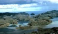
Three Pools mirroring the moon in the West Lake: In West Lake, there are three small islands in which the biggest one is named as “Lesser Yingzhou”, this one is the famous and finest of the remaining two. The scenic view of these three islands and the lake brings the rhythm and beauty of the nature with “lake within the islands and islands within the lake”.
Fishing at Flower Harbor : Flower harbor is located close to the Su causeway. This harbor is comprised of Flower Garden, Red fish Pool,Peony Garden ,Widespread Woods and Lawns. Flower Harbor is the best place for refreshment of one’s mind. This Harbor is becoming famous for day-by-day because of its tourist attractions to the splendid decoration of numerous flowers, goldfish and trees.


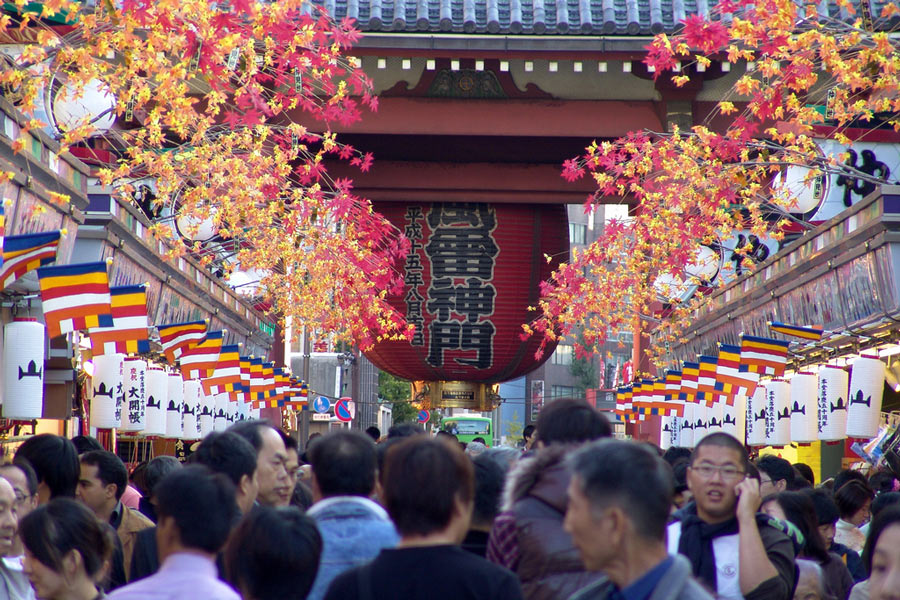


 and Sakura (Cherry) Blossoms in the Front")


 & Khufu (right)")


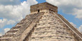
 Step Pyramid, The First Pyramid built in 2630 B.C.")


