Okapi Wildlife Reserve

Epulu_Okapi_Reserve 400
Okapi Wildlife Reserve, Africa
Photo by: Wikimedia Commons, Creative Commons

At 1,372,625 hectares, the Okapi Wildlife Reserve covers around one-fifth of the Ituri forest in the northeastern part of the Democratic Republic of Congo. The reserve was established to protect the high diversity of species, especially those endemic to the Ituri forest. The animal from where it derived its name, the okapi (Okapia johnstoni), is the only living relative of the giraffe. It looks like a stumpy short-necked giraffe and has stripes on its rear legs similar to those of the zebra’s. The reserve is home to around 5,000 okapis. The reserve was listed as a UNESCO World Heritage Site in 1996.

Aside from the okapis, the Okapi Wildlife Reserve is also home to around 4,000 elephants, 2,000 leopards, 300 species of birds, thirteen species of primates including chimpanzees, three species of crocodile, and other animals of the rainforest like the forest buffalo, water chevrotain, forest elephants, insects, and antelope. It is in fact also one of the important sites in mainland Africa dedicated to bird conservation. Its human inhabitants belong to the Mbuti and Efe pygmies who are considered to be one the few remaining “forest people” of the world.

Other than witnessing the culture of these people and seeing the wild animals in their natural habitat, visitors to the Okapi Wildlife Reserve can expect to witness dramatic sceneries such as the Nepoko River in the north and the Ituri River in the south. There are also waterfalls and the majestic Mbiya Mountain situated at the edge of Epulu, overlooking the village. As the reserve is in the middle of the forest, it is a relatively calm and safe place where one can breathe in the fresh air and commune with nature. Camping and jungle activities may be arranged with the reserve’s administrators. As this is still part of the Democratic Republic of Congo, one should still consider taking the necessary safety precautions when traveling.

January 6, 2010 at 1:05 pm | 6 comments

Christ the Redeemer of the Andes

Christ the Redeemer 400
Christ the Redeemer
Photo by: David W, Creative Commons

The statue of Christ the Redeemer of the Andes is a monument erected to celebrate the peaceful resolution of a border dispute between Argentina and Chile. It is located at the La Cumbre pass, which is the highest point on the road between Santiago de Chile and Mendoza in Argentina. La Cumbre pass is also called Iglesia Pass on the Chilean side while in Argentina it is referred to as Bermejo Pass.

At the beginning of the 20th century, Argentina and Chile were close to war with each other over the location of the border. As a reminder to both nations of Christ’s message of peace, the bishop of Cuyo promised to erect a statue of Christ the Redeemer at the disputed area. The sculptor Mateo Alonso was commissioned to build the seven-meter high bronze statue. It was unveiled to the public on the 13th of March in the year 1904. In 2004, the statue’s centenary was celebrated by the reaffirmation of the friendship between Argentina and Chile, with Argentina declaring the statue as a National Historic Monument.

The best time to visit the statue is during the summer as winter temperatures can drop to as low as thirty degrees below zero. Ít’s much safer since the sinuous road is not safe when there is snow.

Visitors can stay in the town of Uspallata when planning a trip to the statue. This little town is popular as a base for skiers in Los Penitentes. Horseback riding, fishing expeditions in the countryside, and treks in the surrounding mountains are other popular activities offered by this town. Check with the town’s tourist office for maps and detailed information on the sights and activities.

January 5, 2010 at 5:37 pm | 1 comment

Mount Ararat

Ararat 400
Mount Ararat above the clouds
Photo by: martijnmunneke, Creative Commons

The city life can take its toll on any visitor. Most people need a change in scenery in order to recharge themselves and provide the perfect relief.

Going to a place with arresting scenery is just what people need to forget the city for a while, and in Turkey, such sceneries are abundant. Among those is Mt Ararat in the easternmost province of Anatolia, Turkey. Also called as Mount Masis in Armenian language, the dormant volcano is a sight to behold with its snow-capped peaks: the Greater Ararat and the Lesser Ararat.

Aside from being a picturesque volcano, Mt Ararat holds great Biblical significance. For years, people have believed that this is the mountain where Noah was said to have settled. Those who have been keen to prove this fact have held expeditions to the mountain in the hopes of finding remains of Noah’s ark. The description in the Bible was “mountains of Ararat”, thus sparking interest among those who wish to substantiate their faith.

Regardless whether the story concerning Noah and Mt Ararat is true or not, tourists can surely appreciate the beauty of this mountain. Seeing the peaks from afar is already a wondrous experience, but hiking to the mountain gives the adventurous travelers a different high.

Climbing Mt Ararat could be a once in a lifetime feat that no traveler would forget, so it is best to prepare months before attempting to hike. Travelers must secure a climbing permit and coordinate with a certified guide, as the Turkish government is keen on these requirements. About two months are needed to arrange everything.

Those wishing to climb Mt Ararat would have an easier time in the late summer, as long as they are fairly handy with the use of axe and crampons. The climb is not a walk in the park, but is said to be less taxing when visiting climbers take the way from the south. The climb may pose a challenge, but travelers will eventually realize that the effort is well worth it.

January 5, 2010 at 5:24 pm | 1 comment

Ardennes

La Roche-en-Ardenne
Ardennes, Belgium
Photo by: Ric Martins, Creative Commons

If you’re in Belgium and looking for a break from the hustle and bustle of cities like Ghent and Brussels, the Ardennes is a clear answer to your wishes. The Ardennes, a part of Wallonia, is a chain of rolling hills and sprawling forests that extends from Belgium and Luxembourg to the outskirts of France. Aside from having an abundance of greenery, it is also a hotspot of natural reserves and rivers.

Ardennes is also an appealing tourist destination for the adventurous types. The vast forests offer hunting, while the hills are suitable for cycling and trekking activities. If you’re in for a short and pleasant walk, you can visit the Parc National de Furfooz. The 4-km circular walk through the park leads you to a scenic view of the town and to several Roman architectural remains. The choice of sports activities does not slow down even in the cold Ardennes winter, where guests can enjoy a little skiing and snowboarding as well.

The Ardennes also holds a part in history. In World War II, the town bore witness to the Battle of the Bulge, a surprise attack by the Germans on the British and American forces. Story has it that they only got as far as Dinant, the fortress of the Allied troops. You can tour the Citadel of Dinant during the day, an enormous WWII fortress perched high above a cliff. Because of some unrestricted sites, most guests are advised to join a tour group, instead of venturing in the citadel alone. The Ardennes American Cemetery also lets you absorb Ardennes’s rich WWII history. The cemetery has a carillon that plays the US National Anthem every day, as homage to the fallen comrades who had been buried there. If you’re quite the patriot, it would prove to be a truly emotional experience to visit this one-of-a-kind resting place.

Whether you’re longing for the crisp air outdoors or for the awe of historical landmarks, Ardennes more than satisfies both of your wishes. A tiny respite from the gray inner cities, Ardennes offers a little peaceful recreation to tourists and natives alike.

January 5, 2010 at 5:14 pm | No comment

Queluz National Palace

Queluz 400
Queluz
Photo by: Husond, Creative Commons

People who always wondered how it was like living in the palace during the times of the royalties’ ages ago can very well take the trip to Queluz National Palace and have a glimpse of what it could have been.

Queluz is in the Municipality of Sintra in the Lisbon District and is known for its marvelous royal palace. Although the town is in a rather unremarkable suburb, exploring the palace alone and seeing Portugal’s finest Rococo architecture is already worth the time and effort.

Queluz National Palace was first built in the 17th century. It served as a manor house for King Pedro II but was eventually transformed into an extravagant palace. Today, it is open to the public while often accommodating guests of the state and some foreign dignitaries. During the summer, it hosts classical music performances as well as equestrian shows.

One of the highlights of the palace is the grandiose throne room. People standing in this room can easily imagine how it was like during the many banquets it had, and how the elegant crystal chandeliers shined hanging from the picturesque architecture of its ceiling. Beyond the throne room is the music room where the orchestra of the queen performed operas and concerts. Another favorite spot in the palace is the royal bedroom. It is a square room with a domed ceiling, spectacular murals of Cervantes’ “Don Quixote”, and a floor decoration of exotic woods that give it a circular illusion.

The original kitchen of the palace is now converted into a restaurant called Cozinha Velha. It retains the old stone chimney, vaulted ceilings, and arches. The restaurant is famous for its desserts, many of which are made from the ancient convent recipes. People also love the gardens in the palace and how they are elaborately adorned by statues and fountains with a classical mythology theme.

Queluz National Palace is a real treat if you love traveling back in time.

January 5, 2010 at 5:12 pm | No comment

Bermuda

Bermuda 400
Bermuda, Caribbean
Photo by: zhengxu , Creative Commons

An interconnection of small islands, Bermuda boasts of its quasi-tropical climate that is suitable for touring around the twenty one mile long island which is a self governing British overseas territory. Although located in near North America, the influence of British rule and the implementation of rules and regulations similar to the British government are very apparent. In total, Bermuda is composed of one city and one town that are both officially considered as incorporated municipalities. Moreover, there are also two additional municipalities present in the island.

The nine parishes that divide the island hold vital attractions to both tourists and also to the locals of Bermuda. These nine different parishes all show the different faces of Bermuda including its rich history and its present developments. St. George Town is one attraction that you should not miss when visiting Bermuda since it is considered one of the oldest heritage sites by UNESCO. The well preserved architecture and the layout of the town with winding streets and cobbled plazas will make you feel as if you’ve travelled back to time.

The Bermudan dollar is the island’s currency and its value is the same as the US Dollar. Both the US and Bermudan dollars are widely accepted in the island so there will be less hassle when it comes to making purchases.

If you want to go shop and find items that are unique or name brand, the Front Street in Hamilton is the place to go. The place is easily accessible by foot and you won’t have any difficulty walking around the stores and finding unique and interesting items. Due to the islands quasi-tropical climate, having a bottle of water is essential when taking a tour during the day where it might get quite hot for you.

January 5, 2010 at 5:06 pm | 4 comments

Xunantunich

Xunantunich 400
Xunantunich, Belize
Photo by: madmack, Creative Commons

If you think of Belize, you might imagine scuba diving in the Belize Barrier Reef or just lounging about the white sandy beaches. What you may not know is that this beach hotspot is also the home of one of the most significant Mayan sites in South America called the Xunantunich Mayan Ruins.

Although the Xunantunich ruins are not the largest of the Mayan settlements, it certainly has its interesting features. Probably the most popular is the El Castillo, the tallest structure in Belize. Perched on a limestone cavern at 135 feet, the El Castillo gives you a panoramic view of the entire Xunantunich ruins and the Belize jungle. From down below, you can also observe the banded decoration which used to outline the perimeter of the El Castillo.

To start your trek through the ruins, it is recommended that you visit the museum first. The museum contains a 3-D model of the whole ruins and also gives you an insight on the history of the Mayan civilization. It also houses a few important relics that have been preserved and protected from the elements. After that, you can start exploring the area before heading off to El Castillo. A path for tourists has been cleared at the front and side of this Mayan ceremonial site. If you’re lucky, you may find a Mayan believer meditating harmoniously with the forces of nature and the Xunantunich gods.

Because of their short-lived existence, the Mayan civilization has been a mystery to present generations. By opening the Mayan settlements to the public, such as in the case of the Xunantunich Ruins, you can get a glimpse of the impressive structures and traditions that mark this fascinating and enigmatic culture.

January 5, 2010 at 4:57 pm | No comment

The Royal Palaces of Abomey

The Royal Palaces of Abomey 400
The Royal Palaces of Abomey, Benin
Photo by: Wikimedia Commons , Creative Commons

Amidst the monarchies of England and France in the 17th to 18th century, little has been known about the kingdoms and fiefdoms in Africa. But, if you get the chance to check out Benin in West Africa, you will find the center of one of the most powerful kingdoms in African history, the Royal Palaces of Abomey.

The Abomey Royal Palaces were constructed by the Fon people between the 17th and 19th centuries. These structures served as lavish dwellings to the twelve successive rulers of the kingdom of Abomey, formerly known as Dahomey. Because the Royal Palace was practically the seat of power in Abomey, it was protected by a mud wall with six guarded gates and surrounded by prickly acacias, a common method of defense in African strongholds. It’s rumored that the sturdiness of the mud walls are because they were made from the blood of human sacrifices to the tribe’s ancestors. During this period, the kings held absolute power over everything in Abomey, even its residents. They enjoyed a life of luxury and prosperity. However, in the 1890s, the Fon people were engaged in a war against the French. France eventually overcame the kingdom and destroyed most of the Royal Palaces of Abomey.

Just like the ones destroyed by the war, the two remaining palaces are simple brick houses with large courtyards. The main attractions for visitors are African artworks, called bas-reliefs, which are on display inside the compound. It is unfortunate that the harsh African weather is slowly contributing to the destruction of this World Heritage Site. Efforts have been extended to preserve the palace buildings, not only for the past they represent, but also for the cultural traditions that they help sustain.

January 5, 2010 at 4:51 pm | 1 comment

Virgin Gorda

Virgin Gorda 400
Virgin Gorda
Photo by: superde1uxe, Creative Commons

Measuring just eight and a half miles long, Virgin Gorda is the 3rd largest island in the British Virgin Islands and the 2nd most populated. Its location is roughly eighteen degrees, forty-eight minutes north, and sixty-four degrees, thirty minutes west. Its area covers about eight square miles or twenty-one square kilometres. It is believed that Christopher Columbus gave the name “The Fat Virgin” to the island for the reason that its outline on the horizon seems like a fat lady reclined on her side.

Virgin Gorda’s main town is the Spanish Town, which is located on the southwest area of the island. The island is surrounded by a lot of deserted beaches and by mid-morning, the sun worshippers will populate either, Handsome Bay, Big Trunk Bay, or Savannah Bay. Virgin Gorda’s pace of life is rather slow. However, if you prefer not to spend your whole day on the beach, there are many other things to do. You can travel around The Baths, where massive rocks look as if they have been arranged by a good-natured giant in order to create a multitude of boulder pools, furtive beaches, and trail ways. This unique geologic arrangement found on the southern tip of the island is what makes the Virgin Gorda one of the British Virgin Islands’ main tourist attractions. You can have a stopover at the Copper Mine placing guard alongside the blue Atlantic. Or simply spend your morning at a restaurant on a hillside cooled by mild breezes while you look at the ferries crossing the North Sound way below.

Spectacular slopes sink from the Gorda Peak into the turquoise streams way below. Not a lot of islands can provide the variety of elite resorts. There are even some resorts that are only reachable by boat.

January 5, 2010 at 4:49 pm | 3 comments

Okavango Delta

Okavango Delta 400
Okavango Delta Game Reserve, Africa
Photo by: Justin , Creative Commons

Touring in the Okavango Delta is comparable to witnessing how the earth has formed for millions of years. Okavango, compared to other parts of the world has remained virtually unchanged for more than sixty five million years which means that the delta is a remnant of the earth’s formation and existence for millions of years.

Witnessing the beauty of the delta and the availability of different kinds of species that inhabit the place is a very rewarding and amazing experience. Being able to see for yourself the beauty and the presence of the great diversity available is a lifetime experience that you could never forget.

What You Should Not Miss

Touring around the delta is a must in order to fully appreciate its beauty and also in order for you to be amazed by how it remained unchanged for millions of years. The vastness of the delta will surely leave you speechless with amazement.

The Okavango River is also another spectacle that you should not miss. The river can either be accessed by boat, by plane, or even by mokoro. The Tsodilo Hills are also a must see when in Okavango Delta. The site which is adorned with more than four thousand paintings has been declared as a UNESCO world heritage site.

What You Should Know

One of the easiest ways to access the Okavango Delta is to get on a safari tour on Moremi Game Reserve. Other tourists rent their own cars and hire an experienced driver to take them from Maun to the Okavango Delta but this will be more expensive.

Staying safe is very important while in Okavango Delta. Follow your guide’s instructions and make sure you protect yourself from mosquitoes since malaria is prevalent in the area. It is also important to stay well hydrated while on tour so bring lots of water stored preferably in a canteen.

January 5, 2010 at 12:48 pm | 2 comments

Copper Canyon

Copper Canyon 400
Copper Canyon
Photo by: Sjors Provoost, Creative Commons

When it comes to natural attractions, Mexico is a haven. Natural wonders abound in this country, and one of them is the Barranca del Cobre, or Copper Canyon in English. The Copper Canyon, located in the state of Chihuahua in Mexico, is a group of six canyons joined together in the Sierra Tarahumara range. Visitors would be surprised to find out that this system of canyons is actually bigger (actually, at least four times larger) than what is considered to be the world’s most breathtaking collection of canyons – the Grand Canyon in the United States. The Copper Canyon was formed in Sierra Tarahumara’s western portion by six rivers which drain in that area. The six rivers merge into the Rio Fuerte and empty into the Cortez Sea. This system of canyons got its name from its walls, which were a copper/green color.

There are two types of weather in the canyon – the mountainous regions have an alpine climate that has moderate temperatures from October until November and March until April. Be amazed by the lush species of pine and the colors of wildflowers the blossom here. Meanwhile, the canyon’s bottom regions have subtropical weather, which means it is rainy there the whole year except from April through June, when it is very warm. You can see huge fig and palm plantations in this area.

There are so many things to do in Copper Canyon. Aside from having your breath taken away by the panoramic view of the canyon, you can also make an event out of getting to the canyons. You may hike, dirt bike, drive, and even go horseback riding when exploring the canyon. Of course, if you’re most of the luxurious type who just wants to take kin the beauty of the view, you can take the train. Along the rail path, you can see a lot of Tarahumara Indians selling indigenous wares and foodstuff.

January 5, 2010 at 12:22 pm | 3 comments

Summerdale

Summerdale is a rural town in south-central Baldwin County, Alabama. It is part of the Daphne–Fairhope–Foley Micropolitan Statistical Area. With roughly 655 people living in the area and it being just minutes away from the beaches of the Gulf of Mexico, Summerdale is a place for peace and relaxation.

Summerdale also has its share of attractions. You can start at the Alligator Alley. Here, you can see 200 alligators enjoying their natural habitat. You can start by walking on the elevated viewing platform and viewing the sunbathing, nesting or courting alligators. If you’re lucky, you might chance upon feeding times and you’ll see the feeding crew walk right to the alligators and feed them! You might also happen to see the alley’s other inhabitant such as turtles, bull frogs, owls, ospreys, etc.

Another one Summerdale’s attraction is the Spear Hunting Museum which welcomed the public in December of the year 2006. The Spear Hunting Museum says just as much as its founder as it says about spear hunting. Gene Morris, the museum’s founder, calls himself “The Greatest Living Spear Hunter in the World.” He is a retired colonel from the Air Force. He hunted animals (the number is estimated at around 400) with the use of only his spears.

The museum also exhibits some of the animals that its founder has killed. The collection includes an American bison, an African lioness, and deer, and alligators. African spears are also on display. These spears have been collected by Morris during his hunting trips. The exhibit also displays the two bent spears, souvenirs from a most exciting adventure.

Summerdale is the place to be if you want to get out of the hectic city life. If you want your peace and quiet, head over to Summerdale now!

January 5, 2010 at 6:55 am | No comment

Museum of Modern Art

moma 400
Museum of Modern Art Reflection
Photo by: Tony the Misfit, Creative Commons

Midtown Manhattan is the place to experience modern lifestyle to its fullest. More than the cradle of fashion, this part of New York City values culture as well. On 53rd Street, between 5th and 6th Avenues, The Museum of Modern Art or MoMA houses an unequalled collection of modern and contemporary art.

The Museum of Modern Art in New York is the most influential museum of its kind in the world. It boasts of varying collections from architecture, visual arts, and electronic media to films. The library alone is a repository of more than 300,000 books with individual informative files on over 70,000 artists. These are such impressive numbers if you were to think that these are primarily about modern and contemporary art only.

Modern masterpieces from all over the world are housed in the Museum of Modern Art in New York. Art works from contemporary masters like van Gogh, Picasso, Dali, Warhol, Gauguin, Monet and Kahlo are hung side by side as if hailing the artists’ diverse talents. The diversity doesn’t stop here. Around 22,000 films and 4 million film stills from all seven continents are being preserved in the Museum, with the belief that cinema is the predominant art form of the 20th century.

The Museum also acknowledges the advancement of technology by exploring multimedia art works. They schedule multiple shows for performance art and screen films every day. Original prints of photographs that graced the pages of history never fail to inspire awe.
Abby Aldrich Rockefeller had enough foresight to see the importance of developing the Museum for the greater good of the modern generation.

January 4, 2010 at 11:52 pm | No comment

Pyramids of Meroe

Pyramids of Meroe 400
Pyramids of Meroe, Sudan
Photo by: Wikimedia Commons , Creative Commons

When one thinks of pyramids, one thinks of Egypt. But Egypt’s influence does not only stop at its borders. A few of its neighbors have been influenced by their culture. One such place is a city named Meroe in the country of Sudan.

Meroe is a city on the east side of the Nile River and was the capital kingdom of Kush for sometime a few centuries ago. The city can be easily recognized due to the presence of more than 200 pyramids that are divided into three groups.

The pyramids found in the city are also called Nubian Pyramids. Nubian pyramids are pyramidal structures that were built on a region called Nubia, an area on the Nile valley, in the present day country of Sudan. This place was ruled by Egypt for some time and greatly influenced the culture of the people who lived there especially in the art of pyramid building. Nubian pyramids are significantly smaller in size than those that can be found in Egypt. They stand at a range of six to thirty feet in height and a base that didn’t exceed much beyond eight feet making the pyramid look tall and the surface walls slant to about seventy degrees.

Many of the pyramids in the city of Meroe are in ruins. Mainly due to the harshness of the climate and lack of ability to maintain the structures throughout the centuries, there are only very few pyramids that are still intact and well preserved. There have been indications that the pyramids were ransacked and plundered of any valuable jewelry that any royal family members entombed in there might have had.

If one enjoys seeing the majesty of the architecture and culture of ancient civilizations, especially those of Egyptians and their influences in neighbouring areas, then the Pyramids of Meroe is a place to see.

January 4, 2010 at 5:40 pm | No comment

Antalya

antalya 400
Antalya Coastline
Photo by: 300td.org, Creative Commons

Located on the Mediterranean coast in Southwestern Turkey, Antalya is one charming city that boasts of breathtaking cliffs and mountains. This city’s picturesque landscapes have made this a perfect spot for visitors with discerning taste.

Antalya is one city that is steeped in a rich history. Through time, it has been called a handful of names; these are Attalia, Andalya, Satalia, and Andalya. During the ancient times, there were several attempts to conquer this city. The plans to capture the area are only testaments that the city is one rich place. The strategic location of the city—which later became a harbor for commerce—was also one huge factor for such attempts.

These days, Antalya is enjoying tranquility. The sun shines here most days of the year, thus making this the ideal destination for those who seek ideal weather. Being a city on the coast, travelers can enjoy frolicking in the beaches. Quite a number of these beaches enjoy a Blue Flag citation, which means that they exhibit ideal environmental conditions.

While most travelers would enjoy their time at the beach by sun bathing by the shore or taking a dip in the refreshing waters, there are so many other things that travelers can do in Antalya. Other water activities like water skiing and wind surfing are also offered here. Moreover, sailing is another activity that would keep travelers busy.

Aside from spending time at the beach, travelers can also explore the slopes. Here, the adventurous ones can go mountain climbing to appreciate the wondrous surroundings of the area. Come March and April, travelers can also go skiing in the slopes of the city. Historical sites are also great places to visit here. Visiting ruins of ancient structures would make travelers understand the history of this place.

Antalya will surely spoil any visitor, as the city also offers sumptuous food, comprising mostly of fresh seafood. Whether visitors come here seeking relaxation or adventure, this city has something for everyone.

January 4, 2010 at 5:24 pm | No comment

Sintra

Sintra 400
Sintra Palace
Photo by: Peter Curbishley, Creative Commons

Sintra is a town in the Estoril Coast region of Portugal. When you ask people in Lisbon whether where it is ideal to visit if you want to explore outside the city, they would surely tell you to go there. It is one of the most delightful spots to go to mainly because of its wide range of greenery—the Serra de Sintra. It is a picturesque mountain range with breathtaking views of the coastline. No wonder Lord Byron called it a glorious garden.

Sintra is not only beautiful because of the Serra. It also boasts of priceless archeological remains especially from the Roman period. There are ancient manor houses, old-fashioned villages, and also artistic churches. Another thing that this town is famous for is their wine production of proven standard. It is also known for traditional confectionery and cooking.

This municipality was declared as World Heritage Site for the cultural landscape which includes: Pena National Palace, Sintra National Palace, Quinta de Regaleira, Monserrate Palace, Castle of the Moors, and Seteais Palace. These are spots you should not miss in case you get the chance to visit this paradise. When you are done with them though, there are still a lot of places to go. Churches, museums, parks, and gardens… You would surely not run out of spots to check and explore.

If you are tired exploring and simply want to unwind, you can just get into a restaurant in the town center and have a taste of their delectable cuisine. If you love shopping, you can also do some here. Visitors usually buy souvenirs and Porto wine in this historic district. There are quite a number of shops that offer usual visitor items like t-shirts, hats, key chains, and post cards. There is a broad selection of products to choose from that you will surely not have a hard time picking which is nice.

January 4, 2010 at 5:12 pm | 1 comment

Canaima National Park

Canaima National Park 400
Canaima National Park, Venezuela
Photo by: Aeruginosa , Creative Commons

Canaima national park is immensely popular for its amazing natural wonders. The lush tropical habitat is home to a wide variety of plants and animals.

Amazing natural wonders like table top mountains known as tepuis can be seen here. Most waterfalls can be easily found which you can climb and explore making it possible for you to get behind the water curtains.

What You Should Not Miss

A trip to the world’s highest waterfalls should not be missed by every tourist who visits Canaima national park. Isla Anatoly is also what you should not miss since it is very near Canaima Village. Other waterfalls are also present in Canaima national park like Salto Sapo which is just in a nearby valley.

A trip to the Auyan tepui should also not be missed when at Canaima National Park. You can secure a permit to trek at Ciudad Bolivar and you can easily get a local to guide you there for a fee.

What You Should Know

The tour to Angels falls will last for three days and two nights and it is actually done by plane, by foot, and through a five hour canoe ride. All tours at the Canaima national park are guided to ensure that you will be safe.

Frequent rainfalls will occur from May to November; however, the dry season from December to April is not an advisable time to visit if you want to see more waterfalls. Consulting weather forecasts for an entire week or an entire month will help you determine whether the weather is suitable for exploration.

Upon arrival at the airport in Canaima, you will need to show proof that you have received vaccination for yellow fever. If not, you will need to pay an additional fee for the shot together with the entrance fee at Canaima which is worth four dollars.

January 4, 2010 at 3:54 pm | 1 comment

Floating Market

Floating Market 400
Busy Floating Market
Photo by: RussBowling, Creative Commons

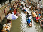
When in Bangkok, Thailand, it’s nice to experience a few adventures from seeing mystical pagodas and biking off the tourist track, to taking the long tail boat to Damnoen Saduak Floating Market, to savoring the culinary Thai specialties.

Passing through the Damnoen Saduak Floating Market is a great opportunity to witness how the locals live – you get a glimpse of their stilt houses, businesses, plus the temple and other aspects of a charismatic way of life – while making your way up the river. If you’re a movie buff who has watched James Bond flicks, you’d recognize the floating market as a spot where one such chase scene was filmed years ago.

Flat boats are laden with produce (ranging from fresh fruits and vegetables, condiments, handicrafts, paintings, souvenirs and other merchandise) peddled by shrewd lady vendors ready to stop and bargain with customers. It all becomes a colorful spectacle somewhat like an unfolding aquatic cultural show, prompting most tourists to click away with their cameras.

Once we arrived we got stuck in, enjoyed it for what it is: an aquatic cultural show festooned with abundant color and souvenirs. It can be an amazing experience. If you intend to be part of the bustling Bangkok floating market scene, try to be up and about early in the morning to experience it at its best. The Damnern Saduak is about 110 kilometers outside Bangkok.

There are organized tours to wend your way to the Bangkok Floating Market or you can choose to paddle your way there at your pace. The market closes, though around middle of the day. Some visitors opt to take the sightseeing & biking tour, which can be exhilarating as it lets them feel central Thailand’s unique spirit. Guests/sightseers get to witness and feel the pace of life in the villages & rice fields, while also paddling to the backwater canals leading to the Damnoen Saduak floating market.

Bangkok Famous Landmarks

January 4, 2010 at 12:14 pm | 1 comment

Alcatraz Island

Alcatraz 400
Escape to Alcatraz
Photo by: http2007, Creative Commons

Located in San Francisco Bay, the Alcatraz Island is unlike any other island you see. Thanks partly to the rich history that took place inside its massive fortifications. But there is more to this island than what you see in films like The Rock and Escape from Alcatraz.

The island’s strategic location made it an excellent choice for a military quarter. And it did become one in 1850 – specifically from the orders of then US president Millard Fillmore. But the island known as The Rock became famous – or infamous in 1934 when it became a federal prison, locking down some of history’s most notorious gangsters and criminals. Who could have thought that the era’s dark figures like Al Capone, George “Machine Gun” Kelly, Alvin Karpis, and Robert Franklin Stroud have all graced its now empty prison cells? It’s funny how an Island aptly named after “pelicans” can have so much notoriety.

By the early ‘60s, the government decided to cease operations as the penitentiary on the island proved to be more expensive than ordinary prison. From then on, this once infamous island has become a visitor destination managed by the National Park Service. Visitors who wish to visit the island can do so by riding a ferry off San Francisco Bay’s Pier 33. Here, visitors can see a glimpse of its old glory – from the prison cell to some of the historical artifacts. Adventure seekers, on the other hand, find this place interesting because of the ghosts that reportedly haunt the island.

The Federal Prison in Alcatraz Island has long been gone. But the legend that it has spawned still remain. It is said that no prisoner escaped in Alcatraz in 29 years of its operation. Some escapees were caught, others were shot and died during their escape, while three were said to have drowned – although the bodies were never found, making some believe that the prisoners have indeed escaped.

January 3, 2010 at 8:12 pm | 1 comment

Ruins of Ephesus

Ephesus 400
Ephesian Library Ruins as mentioned in the Bible
Photo by: Alaskan Dude, Creative Commons

Most people—when they wish to learn something about a specific place—usually go to museums. The stories about a place’s beginnings are represented by artifacts and documents enshrined behind glass panels. While going to museum is a fine idea, going to a place rich in history—much like an outdoor museum—is an entirely different experience.

The Ephesus Ruins is perhaps on of Turkey’s greatest outdoor museums. The place boasts of countless stories, all told through what’s left of the ancient structures. Located south of Selcuk county in Izmir province, the ruins is one destination that should not be missed when one goes to Turkey.

The Ephesus Ruins is comprised of several key spots. Among those is the Odeion, which is also called as the Small Theater. Built around 150 AD, the theater could seat 1,400 people in the semi-circular structure.

The Theater in the Ephesus Ruins boasts of a larger seating capacity; an estimated 44,000 spectators can fit this structure. It is believed that this is the largest outdoor theater during the ancient times.

Another noteworthy structure in the Ephesus Ruins is the Temple of Domitian, which was one of the city’s largest temples. The temple was named after Emperor Domitian, who first gave temple stewardship to Ephesus. While the structure now lays in ruins, visitors would still get a feel of the temple’s grandness.

The Fountain of Pollio is also a hit among visitors in the Ephesus Ruins. The fountain was built to give honor to C. Sectilius Pollio, who was responsible for the construction of the Marnas aqueduct. The fountain is found east of the Domitian square.

In Curetes Street is a handsome edifice called the Temple of Hadrian. The structure—which is believed to have been built by the year 138—boasts of ornately decorated lintels; visitors would marvel at the craftsmanship in the details.

January 3, 2010 at 5:04 pm | 1 comment

Mammoth Caves

Mammoth Cave 400
Inside Mammoth Caves
Photo by: sameerdcosta, Creative Commons

More than 4000 years ago, Native Americans discovered the Mammoth caves. Inside the cave, remnants of ancient torches, sandals and clothing were found that gave clues about the people of the past. In the late 1790s, explorers first went into the cave. From then on, guides have been welcoming visitors and leading them into the caves.

On July 1, 1941, Mammoth Cave, which is located in Kentucky, became a National Park and was considered as a World Heritage Site by the UNESCO on October 27, 1981.

On September 26, 1990, Mammoth Cave was designated as an important International Biosphere Reserve. These recognitions only show how unique and important the Mammoth Caves are, which are worth seeing and will surely give visitors unique experience.

At present, almost 400 miles of the cave system has been already mapped. New caves are still being discovered through continuous explorations. This five-layered cave system is the largest in the world. Approximately, 500,000 visitors come to go spelunking every year and hike 200 to 300 ft below the surface showcasing eroding limestone. Exploring a cave surrounded by darkness and squeezing into some tight spots in the caves will provide the adventure the thrill-seekers are looking for.

People can plan to go to the Mammoth Cave National Park any month of the year, but more visitors come during summer season that’s why there are also more tours to choose from. There’s no entrance fee to the park. There is a fee for the tour, which is relatively cheap. On the other hand, people who wish to go camping also need to pay a fee for each site. Families can enjoy camping at the park or have a tour inside the caves to find out from themselves what the planet we are living in is made of.

January 3, 2010 at 12:00 am | 4 comments

Merida Cable Car

Merida Cable Car 400
Merida Cable Car, Venezula
Photo by: Blmurch , Creative Commons

The Merida cable car is the highest and longest cable car in the world. With a length that spans up to more than twelve kilometers and with an altitude that reaches up to almost five thousand meters, visiting the Merida cable car in Venezuela is something that every tourist should not miss.

Different stations are named after the views and the natural wonders that you will be seeing while riding the cable car. Be physically and emotionally prepared as you will definitely be left breathless once you see the majestic wonders in each station.

What You Should Not Miss

Each station in the Merida cable car is something that you should look out for. From Barinitas, La Montana, La Aguada, Loma Redonda, to Pico Bolivar, the view and the natural formations should not be missed as these are exotic wonders made by nature.

The Virgen de Las Nieves or the Virgin of the Snow is one attraction that you should not miss. From here, you can actually see the highest point which is Pico Bolivar if the weather is not that foggy. Pico Bolivar might seem that close when seen from Virgen de Las Nieves, but it still is actually a six hour trek away.

What You Should Remember

You can actually choose to trek from a station or two but you should be physically prepared for the challenges ahead. Hiring a guide for your trekking expedition will help in ensuring safety and also in making sure that you are on the right path. Also, when walking from one station to another, you will need a permit that you can get from the officials.

Suitable travel time will be from December to February to avoid seeing fog instead of the beautiful scenery. It is also advised that you take time exercising and practicing long walks since the place will require serious physical activities that will easily exhaust you if you are not ready.

January 2, 2010 at 3:54 pm | 3 comments

Na Pali Coast

Na Pali 400
Na Pali Coastline Rainbow
Photo by: roy.luck, Creative Commons

If you wish to experience nature at its best, then all you need to do is visit the northwest side of Kauai. This oldest inhabited Hawaiian island is famous for Na Pali Coast State Park. The park is a stretch of rugged coastline. A picturesque view of the ocean with cliffs that can be seen from all angles is what the Na Pali coastline offers.

Getting to Na Pali Coast alone is an experience worth taking. You would even thank the fact that it is not accessible to automobiles. There are three ways to get there. You can hike and enjoy the lush greens while admiring the blue ocean on the horizon. You can go boating or kayaking into the Park while enjoying the marine life below you. Or you can use a helicopter and still marvel at the spectacular view from above.

The person who coined the phrase nature tripping must have had Na Pali Coast in mind. Nature in all its glory is the primary attraction of this park. The nourishing environment allows days of isolation without missing civilization. Its cliffs boasts of a thick tapestry and narrow valleys that abruptly ends at the sea may appear threatening, but once you smell the salty air coming from the sea mixing with the fragrance of different wild flowers, you will understand why the first Hawaiians chose to settle in this part of the island.

This ancient coast line of Na Pali should definitely be included in your itinerary when you visit Hawaii. The rock walls and terraces throughout the coast line, the lush greens, and the deep blue ocean along with its inhabitants are enough reasons for you to not mind the long hike or boat ride. In fact, part of the adventure is how you get there. A trip to Na Pali Coast is a trip worth taking at least once in our lifetime.

January 1, 2010 at 8:39 pm | 5 comments

Hawaii Volcanoes National Park

HI Volc Nat Park 400
Hawaii Volcanos National Park Drive
Photo by: roadman22, Creative Commons

“In the beginning, the earth was formless and void.” The modern world is now far from being desolate. But wouldn’t it be nice to go back in time and see just how the earth looks like during its formative period? Hawaii Volcanoes National Park might provide a glimpse of what it may have been.

The park is actually the result of many years of the slow flow of lava from volcanic activity. Some experts believe that this volcanic activity was also how Hawaii came to be the island we know it today. In the park’s core are two of the world’s most active volcanoes – the Kilauea and the Mauna Loa. One might think that with these active volcanoes that plants and animals would find it difficult to survive within the area. But the park serves as the refuge for some of the island’s native plants and animals.

Park guides not only welcome visitors to this very unique destination but also work to promote visitors’ understanding and appreciation of the park and the natural occurrence that takes place within the area.

The island weather is somewhat unpredictable. Kilauea’s summit – with an elevation of 4000 feet is at times rainy and chilly. Visitors must wear layers of clothing to ensure comfort as they explore the park. Hiking boots and raingear are a must for visitors who wish to take on the trails.

The 1,348 square kilometers of park land encompasses some the most diverse environments – from the barren desserts to the lush tropical rainforests. About half of this area is surprisingly covered by wilderness where visitors can do their camping and hiking activities. It may not be the destination of choice for most visitors especially when you are in an island known for its pristine beaches and first class resorts – but a visit in this national park will never disappoint any adventure seeker.

January 1, 2010 at 8:16 pm | 3 comments

Dolmabahçe Palace

Dolmabahce
Dolmabahçe Palace

When traveling, visitors are constantly looking for things that surprise them. It is even harder to please those visitors that have seen more places, because their standards have become somewhat higher. One palace in Istanbul, Turkey just might be what travelers need if they are looking for something that will stun them.

The Dolmabahçe Palace is a complex that represents luxury and extravagance. Built between 1843 and 1856, the palace exhibits opulence that is almost unimaginable. It was Sultan Abdülmecid I who commissioned the establishment of the structure, as the family’s former residence did not quite measure up to his standards in luxury.

Evidently, the sultan was very particular with the new residence. The Dolmabahçe Palace used much gold and crystal. In fact, the palace’s gilded ceilings feature gold leaf details; they used fourteen tons of gold leaf for this feature.

Another famous highlight of the Dolmabahçe Palace is the crystal staircase. An elaborate staircase, with a crystal chandelier as the centerpiece, will take anyone’s breath away. The palace also houses the largest Bohemian chandelier in the world. Moreover, the palace also has the world’s largest Baccarat and Bohemian crystal chandeliers in the world.

The walls of the Dolmabahçe Palace Dolmabahçe Palace are filled with paintings done by revered artists. Luxurious carpets from the Hereke Imperial Factory, and century-old bearskin rugs, are also to be found in the palace. Another arresting room in the palace is the bath reserved for men, which features carvings made of alabaster.

Such is the grandeur of the Dolmabahçe Palace, which people can only enter here by joining a guided tour. Now turned into a museum, the palace accepts guests on weekdays except on Mondays and Thursdays, from 9:00 a.m. to 3:00 p.m.

More than being a structure that exhibits over the top luxury, the palace also holds great importance to the Turkish. It was here that their leader, Mustafa Kemal Ataturk, lived and passed away. He died at 9:05 a.m. on November 10, 1938, and to commemorate his death, the clocks in the palace are stopped at the time of his demise.

January 1, 2010 at 5:04 pm | No comment